Cotroceni
 | This article may be expanded with text translated from the corresponding article in Romanian. (January 2015) Click [show] for important translation instructions.
|

Cotroceni on the map of Bucharest
Cotroceni is a neighbourhood in western Bucharest, Romania located around the Cotroceni hill, in Bucharest's Sector 5.
The nearest Metro stations are Eroilor and Politehnica.
Contents
1 History
2 Notable people
3 Landmarks
4 Gallery
5 References
History
The Hill of Cotroceni was once covered by the forest of Vlăsia, which covered most of today's Bucharest.
Here, in 1679 a monastery was built by Şerban Cantacuzino, later to be transformed into a palace in 1888 by Carol I.
Houses were built in the area near the palace by the royal servants and by high-ranking military personnel.
[1]
Carol I also build a royal train station named Gara Cotroceni near the palace. The train station was relocated by the communist regime and was later used for transporting materials for the construction of Casa Poporului.
[2]
Notable people
Important Romanian figures lived in this neighborhood: Nicolae Herlea, Ion Minulescu, Marin Preda, Ion Barbu and Liviu Rebreanu.[1]
Landmarks

Most houses in Cotroceni were built between the two World Wars
Cotroceni Palace, the official residence of the Romanian president, is located in this neighbourhood- Botanical Garden of Bucharest
- Carol Davila University of Medicine and Pharmacy
- The Bucharest Opera building
- Bucharest Municipal Hospital
- Cotroceni Stadium
- St. Elefterie Church
- Casa Radio
Gallery
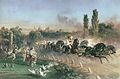
Carol I in the Royal coach in Cotroceni, 1860s
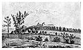
Cotroceni Monastery, 1860

Map of Cotroceni area, circa 1895

References
^ ab "Cotroceni". Ghid.imopedia.ro. Retrieved 2015-02-18..mw-parser-output cite.citationfont-style:inherit.mw-parser-output .citation qquotes:"""""""'""'".mw-parser-output .citation .cs1-lock-free abackground:url("//upload.wikimedia.org/wikipedia/commons/thumb/6/65/Lock-green.svg/9px-Lock-green.svg.png")no-repeat;background-position:right .1em center.mw-parser-output .citation .cs1-lock-limited a,.mw-parser-output .citation .cs1-lock-registration abackground:url("//upload.wikimedia.org/wikipedia/commons/thumb/d/d6/Lock-gray-alt-2.svg/9px-Lock-gray-alt-2.svg.png")no-repeat;background-position:right .1em center.mw-parser-output .citation .cs1-lock-subscription abackground:url("//upload.wikimedia.org/wikipedia/commons/thumb/a/aa/Lock-red-alt-2.svg/9px-Lock-red-alt-2.svg.png")no-repeat;background-position:right .1em center.mw-parser-output .cs1-subscription,.mw-parser-output .cs1-registrationcolor:#555.mw-parser-output .cs1-subscription span,.mw-parser-output .cs1-registration spanborder-bottom:1px dotted;cursor:help.mw-parser-output .cs1-ws-icon abackground:url("//upload.wikimedia.org/wikipedia/commons/thumb/4/4c/Wikisource-logo.svg/12px-Wikisource-logo.svg.png")no-repeat;background-position:right .1em center.mw-parser-output code.cs1-codecolor:inherit;background:inherit;border:inherit;padding:inherit.mw-parser-output .cs1-hidden-errordisplay:none;font-size:100%.mw-parser-output .cs1-visible-errorfont-size:100%.mw-parser-output .cs1-maintdisplay:none;color:#33aa33;margin-left:0.3em.mw-parser-output .cs1-subscription,.mw-parser-output .cs1-registration,.mw-parser-output .cs1-formatfont-size:95%.mw-parser-output .cs1-kern-left,.mw-parser-output .cs1-kern-wl-leftpadding-left:0.2em.mw-parser-output .cs1-kern-right,.mw-parser-output .cs1-kern-wl-rightpadding-right:0.2em
^ [1] Archived September 12, 2011, at the Wayback Machine
 | Wikimedia Commons has media related to Cotroceni. |
Geography of Bucharest, Romania | ||
|---|---|---|
| Sectors of Bucharest |
|  |
| Districts (quarters) |
| |
| Squares |
| |
| Major streets |
| |
| Hills |
| |
| Rivers |
| |
| Lakes |
| |
| Parks and forests |
| |
| See also |
| |
Coordinates: 44°26′7.67″N 26°4′4.03″E / 44.4354639°N 26.0677861°E / 44.4354639; 26.0677861


