Waukesha County, Wisconsin
Waukesha County, Wisconsin | ||
|---|---|---|
County | ||
 Waukesha County Courthouse | ||
| ||
 Map of Wisconsin showing Waukesha County | ||
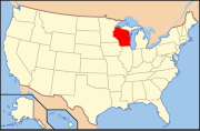 Wisconsin's location in the United States | ||
| Country | ||
| State | ||
| Region | Southeastern Wisconsin | |
| Metro area | Metro Milwaukee | |
| Incorporated | 1846 | |
| County seat | Waukesha, Wisconsin | |
| Largest city | Waukesha, Wisconsin | |
| Area | ||
| • Total | 581 sq mi (1,500 km2) | |
| • Land | 550 sq mi (1,400 km2) | |
| • Water | 31 sq mi (80 km2) | |
| Area rank | 53rd largest county in Wisconsin | |
| Population (2010) | ||
| • Total | 389,891 | |
| • Rank | 3rd largest county in Wisconsin | |
| • Density | 709/sq mi (274/km2) | |
| Time zone | UTC−6 (Central) | |
| • Summer (DST) | UTC−5 (Central) | |
| Area codes | 262, 414 | |
| Congressional districts | 1st, 5th | |
| Interstates | ||
| U.S. Routes | ||
| State Routes | ||
| Airports | Waukesha County Airport Capitol Airport | |
| Website | Waukesha County Official Website | |

Waukesha County sign on WIS 59
Waukesha County is a county in the U.S. state of Wisconsin. As of the 2010 census, the population was 389,891,[1] making it the third-most populous county in Wisconsin. Its county seat is Waukesha.[2]
Waukesha County is included in the Milwaukee–Waukesha–West Allis, WI Metropolitan Statistical Area.
Contents
1 History
1.1 2011 Supreme Court Election
2 Geography
2.1 Lake country
2.2 Adjacent counties
3 Demographics
3.1 2010 census
3.2 2000 census
4 Government
4.1 Elected officials
4.2 Departments
4.3 Politics
5 Communities
5.1 Cities
5.2 Villages
5.3 Towns
5.4 Census-designated place
5.5 Unincorporated communities
5.6 Ghost towns/Neighborhoods
6 See also
7 References
8 Further reading
9 External links
History
The part of Wisconsin that Waukesha County occupies was a part of Michigan Territory when Milwaukee County was organized in September 1834.[3] On July 4, 1836, the Wisconsin Territory was formed, which included land that is now in the state of Minnesota.[3] In January 1846, part of Milwaukee County was split off into Waukesha County.[4][5] Curtis Reed was the first county chairman.[4] When a vote decided the county seat, Waukesha defeated Pewaukee by two votes.[4] The name is derived from the Potawatomi word for 'fox' because the streams in the lower part of the county drain into the Fox River.[6]
Waukesha was a New England settlement, and Waukesha's founders were settlers from New England, particularly Connecticut, rural Massachusetts, Vermont, New Hampshire and Maine, as well as from upstate New York who were born to parents who had migrated there from New England shortly after the American Revolution. These people were "Yankees" descended from the English Puritans who settled New England in the 1600s. They were part of a wave of New England farmers who headed west into what was the wilds of the Northwest Territory during the early 1800s. Most arrived as a result of the completion of the Erie Canal as well as the end of the Black Hawk War.
When they arrived in what is now Waukesha County, there was nothing but dense virgin forest and wild prairie. The New Englanders built farms, roads, government buildings and established post routes. They brought many of their Yankee New England values, such as a passion for education that led to the establishment of many schools as well as staunch support for abolitionism. They were mostly members of the Congregationalist Church, though some were Episcopalian. Due to the second Great Awakening some converted to Methodism, and others became Baptists before moving to what is now Waukesha County. Waukesha, like much of Wisconsin, would be culturally very continuous with early New England culture for most of its early history.[7]
2011 Supreme Court Election
In 2011, the initial unofficial statewide tally in a Wisconsin Supreme Court election had Democratic challenger JoAnne Kloppenburg defeating incumbent justice David Prosser by a 204-vote margin. On the Thursday after the election, Waukesha County Clerk Kathy Nickolaus reported, among other smaller errors, a failure to report votes in the Waukesha city of Brookfield. The newly reported votes gave Prosser the lead, and he retained his seat.[8] Media reports stemming from this incident referred to the county as "crucial Waukesha County," and as of 2017[update], the phrase has continued to be widely used in U.S. political media as an in-joke.[9][10][11]
Geography
According to the U.S. Census Bureau, the county has a total area of 581 square miles (1,500 km2), of which 550 square miles (1,400 km2) is land and 31 square miles (80 km2) (5.3%) is water.[12]
Lake country
Because of its large number of lakes, the northwestern corner of Waukesha County is referred to as "Lake Country" by local residents. It includes Pewaukee, Delafield, Hartland, Merton, Nashotah, Chenequa, Okauchee Lake, Oconomowoc, Summit, and Lac La Belle.
Adjacent counties
Washington County – north
Ozaukee County – northeast
Milwaukee County – east
Racine County – southeast
Walworth County – southwest
Jefferson County – west
Dodge County – northwest
Demographics

2000 Census Age Pyramid for Waukesha County
| Historical population | |||
|---|---|---|---|
| Census | Pop. | %± | |
| 1850 | 19,258 | — | |
| 1860 | 26,831 | 39.3% | |
| 1870 | 28,274 | 5.4% | |
| 1880 | 28,957 | 2.4% | |
| 1890 | 33,270 | 14.9% | |
| 1900 | 35,229 | 5.9% | |
| 1910 | 37,100 | 5.3% | |
| 1920 | 42,612 | 14.9% | |
| 1930 | 52,358 | 22.9% | |
| 1940 | 62,744 | 19.8% | |
| 1950 | 85,901 | 36.9% | |
| 1960 | 158,249 | 84.2% | |
| 1970 | 231,365 | 46.2% | |
| 1980 | 280,326 | 21.2% | |
| 1990 | 304,715 | 8.7% | |
| 2000 | 360,767 | 18.4% | |
| 2010 | 389,891 | 8.1% | |
| Est. 2016 | 398,424 | [13] | 2.2% |
| U.S. Decennial Census[14] 1790–1960[15] 1900–1990[16] 1990–2000[17] 2010–2014[1] | |||
2010 census
As of the census[18] of 2010, there were 389,891 people, 152,663 households, and 108,810 families residing in the county. The population density was 672 people per square mile (260/km²). There were 160,864 housing units at an average density of 277 per square mile (107/km²). The racial makeup of the county was 93.3% White, 1.3% Black or African American, 0.3% Native American, 2.7% Asian, 0.0003% Pacific Islander, 1.0% from other races, and 1.3% from two or more races. 4.1% of the population were Hispanic or Latino of any race.
There were 152,663 households out of which 30.8% had children under the age of 18 living with them, 60.7% were married couples living together, 7.1% had a female householder with no husband present, and 28.7% were non-families. 23.8% of all households were made up of individuals and 10.1% had someone living alone who was 65 years of age or older. The average household size was 2.52 and the average family size was 3.00.
In the county, the population was spread out with 24.1% under the age of 18, 6.8% from 18 to 24, 23.6% from 25 to 44, 31.2% from 45 to 64, and 14.3% who were 65 years of age or older. The median age was 42 years. For every 100 females there were 96.30 males. For every 100 females age 18 and over, there were 93.90 males.
2000 census
As of the census[18] of 2000, there were 360,767 people, 135,229 households, and 100,475 families residing in the county. The population density was 649 people per square mile (251/km²). There were 140,309 housing units at an average density of 252 per square mile (98/km²). The racial makeup of the county was 95.77% White, 0.73% Black or African American, 0.22% Native American, 1.49% Asian, 0.02% Pacific Islander, 0.87% from other races, and 0.90% from two or more races. 2.63% of the population were Hispanic or Latino of any race. 44.5% were of German, 9.2% Polish, 7.5% Italian, and 7.7% Irish ancestry according to Census 2000. 94.3% spoke English, 2.2% Spanish and 1.2% German as their first language.
There were 135,229 households out of which 35.40% had children under the age of 18 living with them, 64.80% were married couples living together, 6.80% had a female householder with no husband present, and 25.70% were non-families. 20.90% of all households were made up of individuals and 8.10% had someone living alone who was 65 years of age or older. The average household size was 2.63 and the average family size was 3.08.
In the county, the population was spread out with 26.30% under the age of 18, 6.80% from 18 to 24, 29.80% from 25 to 44, 25.10% from 45 to 64, and 12.00% who were 65 years of age or older. The median age was 38 years. For every 100 females there were 96.80 males. For every 100 females age 18 and over, there were 94.40 males.
The median income for a household in the county was $62,839, and the median income for a family was $71,773 (these figures had risen to $71,907 and $85,116 respectively as of a 2007 estimate[19]). Males had a median income of $49,232 versus $31,643 for females. The per capita income for the county was $29,164. About 1.7% of families and 2.7% of the population were below the poverty line, including 2.5% of those under age 18 and 4.0% of those age 65 or over.
Government
Elected officials
County Executive: Paul Farrow
County Board Chair: Paul Decker
County Clerk: Kathleen Novack (R)
Treasurer: Pamela F. Reeves (R)
Register of Deeds: James Behrend (R)
Clerk of Circuit Court: Kathy Madden (R)
District Attorney: Susan Opper (interim)
Sheriff: Eric Severson (R)
Departments
There are 12 departments in Waukesha County, with most located in the Administration Center.
- Administration
The Department of Administration has five divisions that provide administrative services to the county: the finance division, the human resources division, the information technology division, the purchasing and risk management division, and the administrative services division.
- Aging and Disability Resource Center
The Aging and Disability Resource Center of Waukesha County (ADRC) provides information, assistance, counseling and supportive services regarding adults age 60 and above, adults with physical or developmental disabilities; and adults with mental health or substance abuse concerns. It also provides publicly funded long-term care to county residents.[20]
- Airport
The Waukesha County Airport serves commercial and private aircraft and is supervised by the Airport Commission.
- Corporation Counsel
- Emergency Preparedness
- Bridges Library System
The Bridges Library System works in partnership with 16 public libraries in Waukesha County to cooperatively provide library services. This includes the purchase of shared electronic databases, summer library programming, and circulation services. Bridges also oversees Internet access for member libraries.
- Health and Human Services
- Medical Examiner
The Medical Examiner investigates suspicious or unexplained deaths or deaths that result from a homicide, suicide, or accident. The office also generates statistics for the county.
- Parks and Land Use
The Department of Parks and Land Use (PLU), oversees six divisions that design and maintain county parks. The division also works with state and federal agencies. The planning division administers permits for construction and landscaping activities. The land conservation division works to educate on and regulate soil and water issues. Most programs look to control water runoff and soil erosion. The recycling and solid waste division oversees recycling and disposal programs. It also performs educational outreach on topics such as composting and waste reduction. The official mascot of the recycling division is Recycle Raccoon. The environmental health division oversees animal welfare issues, food safety, and air, water and sewage, and safety issues (such as radon testing, well testing, and septic system monitoring). The land information systems division coordinates databases of information relating to land use and development.
- Public Works
- Sheriff
- University of Wisconsin Extension
The University of Wisconsin-Extension is a partnership with Waukesha County and brings the research of the UW System to families, businesses, governments, and organizations through educational outreach programs. The UW-Extension office also houses 180° Juvenile Diversion, a non-profit organization that rehabilitates first-time young offenders in Waukesha County.
- Veterans
Politics
Waukesha County has been one of the Republican Party's most solid suburban strongholds for many years. It has not supported a Democrat for president since 1964, and has only supported a Democrat four other times since 1892. While other non-Southern suburban counties have moved towards Democrats since the 1980s, Waukesha and other Milwaukee suburbs have continued to vote solidly Republican.[21] The county is split between 10 state assembly districts and six state senate districts, all held by Republicans.
In 2008, Senator John McCain carried the county by a 25.7% margin over then-Senator Barack Obama, when Obama won Wisconsin by 13.9% over McCain.[22]
| Year | Republican | Democratic | Third parties |
|---|---|---|---|
2016 | 60.0% 142,543 | 33.3% 79,224 | 6.7% 15,826 |
2012 | 66.8% 162,798 | 32.3% 78,779 | 0.9% 2,279 |
2008 | 62.3% 145,152 | 36.6% 85,339 | 1.0% 2,406 |
2004 | 67.3% 154,926 | 32.0% 73,626 | 0.8% 1,811 |
2000 | 65.3% 133,105 | 31.6% 64,319 | 3.1% 6,310 |
1996 | 55.4% 91,729 | 34.7% 57,354 | 9.9% 16,389 |
1992 | 51.0% 91,461 | 28.1% 50,270 | 20.9% 37,451 |
1988 | 60.8% 90,467 | 38.7% 57,598 | 0.6% 828 |
1984 | 65.7% 92,426 | 33.6% 47,313 | 0.7% 921 |
1980 | 58.3% 81,059 | 33.5% 46,612 | 8.3% 11,477 |
1976 | 58.2% 70,418 | 39.3% 47,487 | 2.5% 3,048 |
1972 | 60.9% 59,399 | 35.4% 34,573 | 3.7% 3,650 |
1968 | 55.0% 47,557 | 36.9% 31,947 | 8.1% 7,000 |
1964 | 47.1% 35,502 | 52.8% 39,796 | 0.2% 131 |
1960 | 57.6% 39,380 | 42.3% 28,963 | 0.1% 76 |
1956 | 68.9% 35,212 | 30.3% 15,496 | 0.7% 376 |
1952 | 65.6% 30,238 | 34.2% 15,756 | 0.3% 117 |
1948 | 54.2% 17,324 | 43.7% 13,952 | 2.1% 674 |
1944 | 57.4% 17,995 | 41.6% 13,038 | 0.9% 293 |
1940 | 55.9% 16,726 | 42.9% 12,859 | 1.2% 358 |
1936 | 35.4% 8,921 | 59.5% 14,982 | 5.1% 1,291 |
1932 | 37.8% 8,538 | 59.7% 13,487 | 2.6% 584 |
1928 | 60.2% 12,218 | 38.6% 7,846 | 1.2% 247 |
1924 | 45.5% 7,026 | 12.7% 1,965 | 41.8% 6,468 |
1920 | 71.6% 8,665 | 22.8% 2,759 | 5.6% 673 |
1916 | 45.2% 3,768 | 50.3% 4,192 | 4.5% 375 |
1912 | 36.9% 2,714 | 48.8% 3,594 | 14.3% 1,055 |
1908 | 55.9% 4,758 | 37.7% 3,206 | 6.4% 546 |
1904 | 62.6% 5,247 | 32.1% 2,693 | 5.2% 438 |
1900 | 60.9% 5,127 | 35.8% 3,016 | 3.3% 275 |
1896 | 60.9% 5,411 | 36.0% 3,192 | 3.1% 277 |
1892 | 47.5% 3,600 | 48.0% 3,635 | 4.5% 337 |
Communities
Cities
- Brookfield
- Delafield
Milwaukee (mostly in Milwaukee County and Washington County)- Muskego
- New Berlin
- Oconomowoc
- Pewaukee
Waukesha (county seat)
Villages
- Big Bend
- Butler
- Chenequa
- Dousman
- Eagle
- Elm Grove
- Hartland
Lac La Belle (partly in Jefferson County)- Lannon
- Menomonee Falls
- Merton
Mukwonago (partly in Walworth County)- Nashotah
- North Prairie
- Oconomowoc Lake
- Pewaukee
- Summit
- Sussex
- Wales
Towns
- Brookfield
- Delafield
- Eagle
- Genesee
- Lisbon
- Merton
- Mukwonago
- Oconomowoc
- Ottawa
- Vernon
- Waukesha
Census-designated place
- Okauchee Lake
Unincorporated communities
- Bethesda
- Buena Vista
- Camp Whitcomb
- Colgate
- Eagleville
- Genesee Depot
- Goerke's Corners
- Guthrie
- Jericho
- Lake Five
- Mapleton
- Monches
- Monterey
- North Lake
- Ottawa
- Saylesville
- Stone Bank
- Summit Center
- Summit Corners
- Vernon
Ghost towns/Neighborhoods
- Calhoun
- Dodges Corners
- DeNoon
- Menomonee
- Muskego Settlement
- New Upsala
Note – for zoning purposes, a single acre of Waukesha County was annexed by the city of Milwaukee in 2003 to accommodate the Ambrosia Chocolate Factory.[24]
See also
- National Register of Historic Places listings in Waukesha County, Wisconsin
- Waukesha County gangsters
- Waukesha County Park System
References
^ ab "State & County QuickFacts". United States Census Bureau. Retrieved January 24, 2014..mw-parser-output cite.citationfont-style:inherit.mw-parser-output qquotes:"""""""'""'".mw-parser-output code.cs1-codecolor:inherit;background:inherit;border:inherit;padding:inherit.mw-parser-output .cs1-lock-free abackground:url("//upload.wikimedia.org/wikipedia/commons/thumb/6/65/Lock-green.svg/9px-Lock-green.svg.png")no-repeat;background-position:right .1em center.mw-parser-output .cs1-lock-limited a,.mw-parser-output .cs1-lock-registration abackground:url("//upload.wikimedia.org/wikipedia/commons/thumb/d/d6/Lock-gray-alt-2.svg/9px-Lock-gray-alt-2.svg.png")no-repeat;background-position:right .1em center.mw-parser-output .cs1-lock-subscription abackground:url("//upload.wikimedia.org/wikipedia/commons/thumb/a/aa/Lock-red-alt-2.svg/9px-Lock-red-alt-2.svg.png")no-repeat;background-position:right .1em center.mw-parser-output .cs1-subscription,.mw-parser-output .cs1-registrationcolor:#555.mw-parser-output .cs1-subscription span,.mw-parser-output .cs1-registration spanborder-bottom:1px dotted;cursor:help.mw-parser-output .cs1-hidden-errordisplay:none;font-size:100%.mw-parser-output .cs1-visible-errorfont-size:100%.mw-parser-output .cs1-subscription,.mw-parser-output .cs1-registration,.mw-parser-output .cs1-formatfont-size:95%.mw-parser-output .cs1-kern-left,.mw-parser-output .cs1-kern-wl-leftpadding-left:0.2em.mw-parser-output .cs1-kern-right,.mw-parser-output .cs1-kern-wl-rightpadding-right:0.2em
^ "Find a County". National Association of Counties. Retrieved 2011-06-07.
^ ab Barquist, Barbara; Barquist, David (1987). "The Beginning". In Haley, Leroy. The Summit of Oconomowoc: 150 Years of Summit Town. Summit History Group. p. 6.
^ abc Barquist, Barbara; Barquist, David (1987). "The Beginning". In Haley, Leroy. The Summit of Oconomowoc: 150 Years of Summit Town. Summit History Group. p. 7.
^ Barquist, Barbara; Barquist, David (1987). "The Early Years". In Haley, Leroy. The Summit of Oconomowoc: 150 Years of Summit Town. Summit History Group. p. 37.
^ "Winnebago Took Its Name from an Indian Tribe". The Post-Crescent. December 28, 1963. p. 14. Retrieved August 25, 2014 – via Newspapers.com.
^ The History of Waukesha County, Wisconsin: Containing an Account of Its Settlement, Growth, Development and Resources; an Extensive and Minute Sketch of Its Cities, Towns and Villages--their Improvements, Industries, Manufactories, Churches, Schools and Societies; Its War Record, Biographical Sketches, Portraits of Prominent Men and Early Settlers; the Whole Preceded by a History of Wisconsin, Statistics of the State, and an Abstract of Its Laws and Constitution and of the Constitution of the United States Western Historical Company, 1880 pages 173, 232, 233
^ Stein, Jason; Walker, Laurel; Glauber, Bill (7 April 2011). "Corrected Brookfield tally puts Prosser ahead after 7,500-vote gain". Milwaukee Journal-Sentinel. Retrieved 14 July 2017.
^ Gallitz, Sean (5 April 2016). "The Wisconsin county that could stop Donald Trump". CBS News. Retrieved 14 July 2017.
^ Kondik, Kyle (5 May 2014). "10 Maps That Explain the 2014 Midterms". POLITICO. Retrieved 14 July 2017.
^ Gehrke, Joel (20 February 2015). "Ron Johnson, Ready Already for 2016". National Review. Retrieved 14 July 2017.
^ "2010 Census Gazetteer Files". United States Census Bureau. August 22, 2012. Retrieved August 9, 2015.
^ "Population and Housing Unit Estimates". Retrieved June 9, 2017.
^ "U.S. Decennial Census". United States Census Bureau. Retrieved August 9, 2015.
^ "Historical Census Browser". University of Virginia Library. Retrieved August 9, 2015.
^ Forstall, Richard L., ed. (March 27, 1995). "Population of Counties by Decennial Census: 1900 to 1990". United States Census Bureau. Retrieved August 9, 2015.
^ "Census 2000 PHC-T-4. Ranking Tables for Counties: 1990 and 2000" (PDF). United States Census Bureau. April 2, 2001. Retrieved August 9, 2015.
^ ab "American FactFinder". United States Census Bureau. Retrieved 2011-05-14.
^ "Waukesha County, Wisconsin – Fact Sheet – American FactFinder". Factfinder.census.gov. Retrieved 2010-07-22.
^ Mission Statement from "Archived copy". Archived from the original on 2008-05-22. Retrieved 2008-05-20.CS1 maint: Archived copy as title (link)
^ Cohn, Nate (6 May 2014). "The Curious Case of Milwaukee's Suburban Voters". New York Times. Retrieved 7 May 2014.
^ 2008 U.S. Presidential Election Results
^ Leip, David. "Dave Leip's Atlas of U.S. Presidential Elections". uselectionatlas.org. Retrieved 2018-08-14.
^ Mike Mulvey. "Colleges squaring off over taxes". Milwaukee Sentinel, May 18, 1991, part 1, p. 6.
Further reading
- Haight, Theron W. (ed.) Memoirs of Waukesha County. Madison: Western Historical Association, 1907.
The History of Waukesha County, Wisconsin. Chicago: Western Historical Company, 1880.
Portrait and Biographical Record of Waukesha County, Wisconsin. Chicago: Excelsior Publishing Co. 1894.
External links
| Wikimedia Commons has media related to Waukesha County, Wisconsin. |
- Waukesha County Official Website
Waukesha County map from the Wisconsin Department of Transportation
Places adjacent to Waukesha County, Wisconsin | ||||||||||
|---|---|---|---|---|---|---|---|---|---|---|
| ||||||||||
Municipalities and communities of Waukesha County, Wisconsin, United States | ||
|---|---|---|
County seat: Waukesha | ||
| Cities |
|  |
| Villages |
| |
| Towns |
| |
| CDP |
| |
| Unincorporated communities |
| |
| Ghost towns/ neighborhoods |
| |
| Footnotes | ‡This populated place also has portions in an adjacent county or counties | |
Milwaukee metropolitan area | ||
|---|---|---|
| Central city |
|  |
| Largest municipalities (over 25,000 in 2010) |
| |
| Municipalities (over 10,000 in 2010) |
| |
| Smaller municipalities (under 10,000 in 2010) |
| |
| Counties |
| |
Notes: Vvillage Ttown Ccity | ||
Madison (capital) | ||
| Topics |
|  |
| Society |
| |
| Regions |
| |
Major metropolitan areas (pop. over 500,000) |
| |
Largest cities (pop. over 50,000) |
| |
Smaller cities (pop. 15,000 to 50,000) |
| |
Largest villages (pop. over 15,000) |
| |
| Counties |
| |
Coordinates: 43°01′N 88°19′W / 43.02°N 88.31°W / 43.02; -88.31

