Sokołów Podlaski
Sokołów Podlaski | |||
|---|---|---|---|
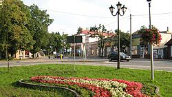 City center | |||
| |||
 Sokołów Podlaski | |||
| Coordinates: 52°24′24″N 22°14′47″E / 52.40667°N 22.24639°E / 52.40667; 22.24639 | |||
| Country | |||
| Voivodeship | Masovian | ||
| County | Sokołów | ||
| Gmina | Sokołów Podlaski (urban gmina) | ||
| Town rights | 1424 | ||
| Government | |||
| • Mayor | Bogusław Jan Karakula | ||
| Area | |||
| • Total | 17.5 km2 (6.8 sq mi) | ||
| Population (2013[1]) | |||
| • Total | 18,720 | ||
| • Density | 1,100/km2 (2,800/sq mi) | ||
| Time zone | UTC+1 (CET) | ||
| • Summer (DST) | UTC+2 (CEST) | ||
| Postal code | 08-300, 08–301 | ||
| Area code(s) | +48 25 | ||
| Car plates | WSK | ||
| Website | http://www.sokolowpodl.pl | ||


Sokołów Podlaski [sɔˈkɔwuf pɔdˈlaski] is a town in Poland, in Masovian Voivodeship, about 80 kilometres (50 miles) east of Warsaw. It is the capital of Sokołów County. Population is 18,434 as for 2004 (18,720 in 2013).
First settlement in the 6th century. It received the city charter in 1424. The town lies on the Cetynia river, in the historical region of Podlachia. According to data from 2010 Sokołow had 18 481 inhabitants.[2]
History
The beginnings of settlement in this area dates back to 6th century AD. The Sokołów area belongs to that part of Podlachia, which, due to its location, was a typical settler outpost. This area in early Medieval was a scene of the feudal fights between Polish and Russian state, the Teutonic Knights, Yotvingians and Lithuanians. Political history of this land strongly influenced its cultural development and progress of colonisation. The archaeological research was conducted to determinate the cultural and ethnic structure of the settlements. Quite numerous archaeological sites from early Middle Ages was found in the area, which allowed the scientists to accurately reproduce phases of colonisation process and the character of defensive and residential building structures of the settlements. Archaeologists found evidence of settlements in the area dated from 6th and 7th centuries. Ceramics, iron fittings, buckles, beads, staples and numerous items of burial equipment testify about the culture, customs and rituals celebrated to honour the dead. The study confirmed that in a place of old Russian and Polish settlements in the Cetynia river valley, as a result of gradual colonisation, new settlement of Sokołów was established.[3]
Sokołów Podlaski received city rights in 1424, from the Grand Duke of Lithuania Witold.[4]
In 1508 Stanisław Kiszka became the new owner of the town. Sokołów belonged to Kiszka until 1592, when it was passed to the Radziwiłł family. For Sokołów it was a time of the greatest prosperity in its history, uninterrupted until Swedish invasion in the middle of the 17th century. During the war with Sweden the city was significantly damaged. In 1657 Rakoczy's army burned down the town together with surrounding farms. During the Reformation, the city is one of the strongest centers of Arianism in Podlasie.[5]
In 1668 Jan Krasiński became new the owner of the town. After the second half of the 18th century the town belonged to the Ogiński family. Under their rule craftsmanship quickly developed in Sokołów. Michał Kleofas Ogiński brought French craftsmen who started the production of silk scarves, hats, rugs, linen and Slutsk sashs.[6]
After the third partition of Poland Sokołów fell under Austrian rule, and after the Polish-Austrian war, in 1809, returned to the Duchy of Warsaw. In 1833 the town was purchased from Michał Kleofas Ogiński by local landowner Karol Kobyloński, who 10 years later sold it to Elżbieta Hirschman. The new owner in 1845 established sugar factory "Elżbietów" in Przeździatce (today outskirts of Sokołów Podlaski) and in 1890, the factory employed 600 workers.[7] The sugar factory played an important role for the development of the city and local agriculture.
During the January Insurrection lokal priest Stanisław Brzóska became famous leader of the Polish resistance against Russian rule. He was arrested and sentenced by the tsarist authorities to death by hanging. The sentence was executed in the town centre on 23 May 1865. In 1925 a granite monument was erected as a memorial at the site of Brzóska's execution.[8]
In 1867 the Sokołów became the property of the state and was the district office was established there.[9] In 1887, after the construction of the railway line, the city became an important communication link. Between 1845–1890 the population of the town doubled, mostly thanks to the immigrants, majority of which were Jews, who, being artisans, craftsmen and merchants, made a great contribution to the further development of the town. During this period new factories were opened in addition to the sugar factory.[10]
During World War II Sokołów suffered heavy losses. As a result of the war 30% of residential and 70% of official buildings were destroyed and the population was drastically reduced. With the beginning of German occupation, many Jews fled. For those who left in August 1941 German authorities created a ghetto, which existed until the end of September 1942. A significant number of Jewish population was killed in the ghetto, others were transported to the Treblinka extermination camp. The liberation of the city took place on 8 August 1944.
References
^ Demographic Yearbook of Poland 2014 Archived 2016-02-20 at the Wayback Machine.
^ Ludność. Stan i struktura w przekroju terytorialnym (Stan w dniu 31 XII 2010 r.). Warszawa: Główny Urząd Statystyczny, 2011-06-10. ISSN 1734-6118.
^ http://www.sokolowpodl.pl/index.php?module=News&func=display&sid=350
^ https://la.wikisource.org/wiki/Locatio_oppidi_Sokolow,_terra_Podlassia
^ http://www.sokolow.4web.pl/sokolow_podlaski_hist-prz.htm
^ http://www.sokolowpodl.pl/index.php?module=News&func=display&sid=350
^ http://www.sokolowpodl.pl/index.php?module=News&func=display&sid=350
^ http://www.sokolow.4web.pl/sokolow_podlaski_hist-prz.htm
^ http://www.powiat-sokolowski.pl/powiat/historia-powiatu
^ http://www.sokolow.4web.pl/sokolow_podlaski_hist-prz.htm
External links
- Official town webpage
- Sokolow Podlaski, from the Encyclopedia of Jewish Communities in Poland
Jewish Community in Sokołów Podlaski on Virtual Shtetl
| Wikimedia Commons has media related to Sokołów Podlaski. |
Coordinates: 52°24′N 22°15′E / 52.400°N 22.250°E / 52.400; 22.250
Gminas of Sokołów County | ||
|---|---|---|
Seat: Sokołów Podlaski (urban gmina) | ||
| Urban-rural gmina |
| |
| Rural gminas |
| |
Authority control |
|
|---|


