Madang
Madang | |
|---|---|
Town | |
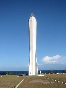 Coastwatchers Memorial Lighthouse, Kalibobo, Madang | |
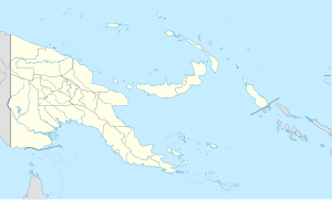 Madang Location in Papua New Guinea | |
| Coordinates: 5°13′S 145°48′E / 5.217°S 145.800°E / -5.217; 145.800Coordinates: 5°13′S 145°48′E / 5.217°S 145.800°E / -5.217; 145.800 | |
| Country | |
| Province | Madang Province |
| District | Madang District |
| Established | 1884 |
| Elevation | 3 m (10 ft) |
| Population (2013) | |
| • Total | 29,339 |
| Time zone | UTC+10 (AEST) |
| Climate | Af |
Madang (old German name: Friedrich-Wilhelmshafen[1]) is the capital of Madang Province and is a town with a population of 27,420 (in 2005) on the north coast of Papua New Guinea. It was first settled by the Germans in the 19th century.
Contents
1 History
2 NGO presence in Madang
3 Transport
4 Climate
5 Education
6 Products
7 Images
8 See also
9 References
10 External links
11 Notes
History
Russian biologist Nicholai Miklukho-Maklai was probably the first European to visit the area. In 1871 he stayed at Astrolabe Bay south of present-day Madang for 15 months. He had a good relationship with the local communities before leaving, suffering from malaria.
In April 1884 an expedition by the German New Guinea Company led by Otto Finsch and Eduard Dallmann arrived and named the landing point "Friedrich Wilhelmshafen"; however, they felt that the area was unsuitable for a settlement. A subsequent survey in 1888 mentioned good soil conditions that would make a coffee plantation possible. In the summer of 1891 a station was built and by September 1892 was the seat of the provincial administration; however, the Imperial Government Commissioner remained at Stephansort, some 23 kilometers away due to concerns about malaria. The name of "Madang" was used by Papuan natives who had accompanied the German administrators after their home island and only became the official name of the settlement towards the end of the German administration. Although the settlement was expanded from 1893-1894 with warehouses, a sawmill, hospital and other facilities, (including an ox-drawn railway to Stephansort) various ventures, such as the coffee plantations and atap palm processing proved economically ruinous, due to malaria and inclement climate. From 1895 and 1896 several German warships were stationed here for a survey of surrounding waters, during which time a total of 295 men came down with malaria. In 1899 the capital of the New Guinea Company was transferred to Herbertshöhe on the island of New Pomerania (now New Britain).
Following World War I, the area was turned over to Australia as part of the League of Nations mandated Territory of New Guinea.
The Imperial Japanese Army captured Madang without a fight during World War II in 1942. In September 1943, Australian forces launched a sustained campaign to retake the Finisterre Range and Madang. The town was captured on April 24, 1944, but during the fighting and occupation it was virtually destroyed and had to be rebuilt afterwards.
NGO presence in Madang
Madang is viewed by many in the country as being safer and more pleasant for expatriates than the larger cities of Lae and Port Moresby. Because of this, some NGOs have chosen Madang as the location of their main offices in country.
CUSO (a Canadian NGO) and VSO (a British NGO) both have their headquarters in Madang.
Save the Children, WWF, and World Vision are also present with branch offices in Madang.
As a consequence Madang has a larger number of expatriates working and living in the town than its small population would suggest.
Transport
Climate
| Climate data for Madang | |||||||||||||
|---|---|---|---|---|---|---|---|---|---|---|---|---|---|
| Month | Jan | Feb | Mar | Apr | May | Jun | Jul | Aug | Sep | Oct | Nov | Dec | Year |
| Record high °C (°F) | 33.2 (91.8) | 33.3 (91.9) | 33.3 (91.9) | 33.7 (92.7) | 32.2 (90.0) | 32.2 (90.0) | 31.5 (88.7) | 31.7 (89.1) | 33.4 (92.1) | 31.7 (89.1) | 32.5 (90.5) | 33.6 (92.5) | 33.7 (92.7) |
| Average high °C (°F) | 30.8 (87.4) | 30.6 (87.1) | 30.6 (87.1) | 30.6 (87.1) | 30.7 (87.3) | 30.4 (86.7) | 30.2 (86.4) | 30.2 (86.4) | 30.5 (86.9) | 30.9 (87.6) | 31.2 (88.2) | 30.9 (87.6) | 30.6 (87.1) |
| Average low °C (°F) | 23.9 (75.0) | 23.8 (74.8) | 23.9 (75.0) | 23.8 (74.8) | 23.9 (75.0) | 23.7 (74.7) | 23.4 (74.1) | 23.7 (74.7) | 23.6 (74.5) | 23.8 (74.8) | 23.9 (75.0) | 23.9 (75.0) | 23.8 (74.8) |
| Record low °C (°F) | 21.0 (69.8) | 20.7 (69.3) | 20.8 (69.4) | 21.1 (70.0) | 20.1 (68.2) | 19.9 (67.8) | 20.0 (68.0) | 18.9 (66.0) | 20.8 (69.4) | 20.3 (68.5) | 20.0 (68.0) | 19.4 (66.9) | 18.9 (66.0) |
| Average rainfall mm (inches) | 343.8 (13.54) | 292.0 (11.50) | 329.8 (12.98) | 389.4 (15.33) | 343.4 (13.52) | 186.4 (7.34) | 144.2 (5.68) | 93.8 (3.69) | 82.6 (3.25) | 239.2 (9.42) | 280.2 (11.03) | 382.0 (15.04) | 3,106.8 (122.31) |
| Average rainy days | 23 | 21 | 23 | 23 | 21 | 18 | 15 | 12 | 11 | 15 | 19 | 23 | 224 |
| Average relative humidity (%) | 85 | 85 | 85 | 85 | 85 | 84 | 84 | 82 | 83 | 83 | 84 | 84 | 84 |
| Mean monthly sunshine hours | 160 | 140 | 144 | 162 | 193 | 195 | 198 | 210 | 227 | 210 | 185 | 160 | 2,184 |
| Source #1: World Meteorological Organisation[2] | |||||||||||||
| Source #2: Deutscher Wetterdienst (extremes, humidity and sun)[3][4][a] | |||||||||||||
Education
Madang is the home of Divine Word University.
Products
Industry and farming are growing constantly in importance, especially for export. There are the widespread coconut palm plantations on the coast and cardamum is grown in Madang.
The Kulili plantation is the second largest of Kar Kar Island's twelve plantations with its more than a thousand coconut palms and cocoa trees. 70% of the cocoa and 50% of the copra produced in Madang province comes from Kar Kar.
In Madang province 173 regional languages are spoken, some of them being extremely different from the others.
Images

Madang Airport
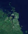
Madang from space

Madang lagoon


See also
- Bilibil
- List of towns in Papua New Guinea
References
^ The New Encyclopædia Britannica (1974), Micropædia Vol. 6 (15th ed.). p. 467..mw-parser-output cite.citationfont-style:inherit.mw-parser-output .citation qquotes:"""""""'""'".mw-parser-output .citation .cs1-lock-free abackground:url("//upload.wikimedia.org/wikipedia/commons/thumb/6/65/Lock-green.svg/9px-Lock-green.svg.png")no-repeat;background-position:right .1em center.mw-parser-output .citation .cs1-lock-limited a,.mw-parser-output .citation .cs1-lock-registration abackground:url("//upload.wikimedia.org/wikipedia/commons/thumb/d/d6/Lock-gray-alt-2.svg/9px-Lock-gray-alt-2.svg.png")no-repeat;background-position:right .1em center.mw-parser-output .citation .cs1-lock-subscription abackground:url("//upload.wikimedia.org/wikipedia/commons/thumb/a/aa/Lock-red-alt-2.svg/9px-Lock-red-alt-2.svg.png")no-repeat;background-position:right .1em center.mw-parser-output .cs1-subscription,.mw-parser-output .cs1-registrationcolor:#555.mw-parser-output .cs1-subscription span,.mw-parser-output .cs1-registration spanborder-bottom:1px dotted;cursor:help.mw-parser-output .cs1-ws-icon abackground:url("//upload.wikimedia.org/wikipedia/commons/thumb/4/4c/Wikisource-logo.svg/12px-Wikisource-logo.svg.png")no-repeat;background-position:right .1em center.mw-parser-output code.cs1-codecolor:inherit;background:inherit;border:inherit;padding:inherit.mw-parser-output .cs1-hidden-errordisplay:none;font-size:100%.mw-parser-output .cs1-visible-errorfont-size:100%.mw-parser-output .cs1-maintdisplay:none;color:#33aa33;margin-left:0.3em.mw-parser-output .cs1-subscription,.mw-parser-output .cs1-registration,.mw-parser-output .cs1-formatfont-size:95%.mw-parser-output .cs1-kern-left,.mw-parser-output .cs1-kern-wl-leftpadding-left:0.2em.mw-parser-output .cs1-kern-right,.mw-parser-output .cs1-kern-wl-rightpadding-right:0.2em
^ "World Weather Information Service — Madang". World Meteorological Organisation. Retrieved 15 December 2015.
^
"Klimatafel von Madang / Papua-Neuguinea" (PDF). Baseline climate means (1961-1990) from stations all over the world (in German). Deutscher Wetterdienst. Retrieved 29 January 2016.
^
"Station 92014 Madang W.O". Global station data 1961–1990—Sunshine Duration. Deutscher Wetterdienst. Retrieved 29 January 2016.
External links
"When the Japanese bombed Magang (sic): Bob Emery". Papua New Guinea Association of Australia. 16 September 2015. Retrieved 23 April 2016.. An eyewitness recollection of the 1942 Japanese attack on Madang
| Wikimedia Commons has media related to Madang. |
| Wikivoyage has a travel guide for Madang. |
Notes
^ Station ID for Madang W.O is 92014 Use this station ID to locate the sunshine duration
Provincial capitals of Papua New Guinea | ||
|---|---|---|
| ||
Authority control |
|
|---|


