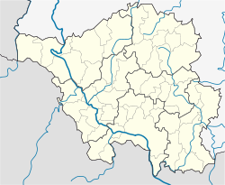
Oberthal, Saarland
Oberthal | ||
|---|---|---|
| ||
Location of Oberthal | ||
 Oberthal Show map of Germany  Oberthal Show map of Saarland | ||
| Coordinates: 49°31′N 7°5′E / 49.517°N 7.083°E / 49.517; 7.083Coordinates: 49°31′N 7°5′E / 49.517°N 7.083°E / 49.517; 7.083 | ||
| Country | Germany | |
| State | Saarland | |
| District | Sankt Wendel | |
| Government | ||
| • Mayor | Stephan Rausch (CDU) | |
| Area | ||
| • Total | 23.86 km2 (9.21 sq mi) | |
| Elevation | 349 m (1,145 ft) | |
| Population (2017-12-31)[1] | ||
| • Total | 6,023 | |
| • Density | 250/km2 (650/sq mi) | |
| Time zone | CET/CEST (UTC+1/+2) | |
| Postal codes | 66649 | |
| Dialling codes | 06854 | |
| Vehicle registration | WND | |
| Website | www.oberthal.de | |
Oberthal is a municipality in the district of Sankt Wendel, in Saarland, Germany. It is situated approximately 7 km northwest of Sankt Wendel, and 35 km north of Saarbrücken.
References
^ "Fläche und Bevölkerung - Stand: 31.12.2017 (Basis Zensus 2011)" (PDF). Statistisches Amt des Saarlandes (in German). September 2018..mw-parser-output cite.citationfont-style:inherit.mw-parser-output .citation qquotes:"""""""'""'".mw-parser-output .citation .cs1-lock-free abackground:url("//upload.wikimedia.org/wikipedia/commons/thumb/6/65/Lock-green.svg/9px-Lock-green.svg.png")no-repeat;background-position:right .1em center.mw-parser-output .citation .cs1-lock-limited a,.mw-parser-output .citation .cs1-lock-registration abackground:url("//upload.wikimedia.org/wikipedia/commons/thumb/d/d6/Lock-gray-alt-2.svg/9px-Lock-gray-alt-2.svg.png")no-repeat;background-position:right .1em center.mw-parser-output .citation .cs1-lock-subscription abackground:url("//upload.wikimedia.org/wikipedia/commons/thumb/a/aa/Lock-red-alt-2.svg/9px-Lock-red-alt-2.svg.png")no-repeat;background-position:right .1em center.mw-parser-output .cs1-subscription,.mw-parser-output .cs1-registrationcolor:#555.mw-parser-output .cs1-subscription span,.mw-parser-output .cs1-registration spanborder-bottom:1px dotted;cursor:help.mw-parser-output .cs1-ws-icon abackground:url("//upload.wikimedia.org/wikipedia/commons/thumb/4/4c/Wikisource-logo.svg/12px-Wikisource-logo.svg.png")no-repeat;background-position:right .1em center.mw-parser-output code.cs1-codecolor:inherit;background:inherit;border:inherit;padding:inherit.mw-parser-output .cs1-hidden-errordisplay:none;font-size:100%.mw-parser-output .cs1-visible-errorfont-size:100%.mw-parser-output .cs1-maintdisplay:none;color:#33aa33;margin-left:0.3em.mw-parser-output .cs1-subscription,.mw-parser-output .cs1-registration,.mw-parser-output .cs1-formatfont-size:95%.mw-parser-output .cs1-kern-left,.mw-parser-output .cs1-kern-wl-leftpadding-left:0.2em.mw-parser-output .cs1-kern-right,.mw-parser-output .cs1-kern-wl-rightpadding-right:0.2em
This Saarland location article is a stub. You can help Wikipedia by expanding it. |
