Mineral County, West Virginia
Mineral County, West Virginia | |
|---|---|
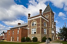 Mineral County Courthouse in Keyser | |
 Location in the U.S. state of West Virginia | |
 West Virginia's location in the U.S. | |
| Founded | February 1, 1866 |
| Seat | Keyser |
| Largest city | Keyser |
| Area | |
| • Total | 329 sq mi (852 km2) |
| • Land | 328 sq mi (850 km2) |
| • Water | 1.4 sq mi (4 km2), 0.4% |
| Population (est.) | |
| • (2015) | 27,451 |
| • Density | 84/sq mi (32/km2) |
| Congressional district | 1st |
| Time zone | Eastern: UTC−5/−4 |
| Website | www.mineralcountywv.com |
Mineral County is a county in the U.S. state of West Virginia. It is part of the Cumberland, MD-WV Metropolitan Statistical Area. As of the 2010 census, the population was 28,212.[1] Its county seat is Keyser.[2] The county was founded in 1866.[3]
Mineral County is part of the Cumberland, MD-WV Metropolitan Statistical Area.
Contents
1 History
1.1 Ancient history
1.2 1863 to present
2 Geography
2.1 Mountains
2.2 Rivers
2.3 Minerals
3 Demographics
3.1 2000 census
3.2 2010 census
4 Politics
5 Government
5.1 County Commission
5.1.1 Commissioners
5.1.2 Appointed commissions
5.2 Office of Assessor
5.2.1 Circuit Clerk
5.3 County Clerk
5.4 State Representatives
5.4.1 House of Delegates
5.4.2 Senate
6 Economy
6.1 Industrial parks
7 Education
7.1 High schools
7.2 Colleges
8 Transportation
8.1 Airport
8.2 Rail
8.3 Major highways
9 Parks and public recreational attractions
9.1 Larenim Park
9.2 Barnum Whitewater Area
9.3 MINCO Park
9.4 Van Myra Campground
9.5 Dam Site #21
9.6 Jennings Randolph Lake
9.7 Golf courses
10 Communities
10.1 City
10.2 Towns
10.3 Census-designated places
10.4 Unincorporated communities
10.5 Districts
11 Historical sites
12 Notable people
13 See also
14 References
History
Ancient history
Indigenous peoples lived throughout the highlands along rivers in this area for thousands of years. Archeologists have identified artifacts of the Adena culture, dating from 1000 BC to 200 BC. They were among the several early Native American cultures who built major earthwork mounds for ceremonial and burial use. Remnants of their culture have been found throughout West Virginia. They were followed by other indigenous peoples.
With the growth of fur trading to the north after European encounter in the coastal areas, the nations of the Haudenosaunee (or Iroquois Confederacy), based in present-day New York, moved into the Ohio Valley in search of new hunting grounds. By the 17th century they had conquered other tribes, pushed them out to the west, and preserved the area for hunting.
1863 to present
It was not until after West Virginia became a state in 1863 that present-day Mineral County was organized. It was created in 1866 by an Act of the West Virginia Legislature from the existing Hampshire County. The name was selected due to its reserves of minerals, especially coal (although, technically, coal is not a true mineral).
The seminal point in the creation of the county was the arrival of the main line of the Baltimore and Ohio Railroad in 1842. The county seat of Keyser was named for an executive of the railroad.
[4]
Geography
According to the U.S. Census Bureau, the county has a total area of 329 square miles (850 km2), of which 328 square miles (850 km2) is land and 1.4 square miles (3.6 km2) (0.4%) is water.[5]
Mountains
The northern terminus of the Allegheny Front in West Virginia lies in Mineral County, and contains the highest point in the county. Known as the Pinnacle it is 3,104 feet (946 m) above sea level. From the abandoned fire tower four states are visible, Pennsylvania, Maryland, West Virginia, and Virginia. The Allegheny Front is the largest mountain in the county; on the north end it is also known as Green Mountain. On top of the Allegheny Plateau is located the town of Elk Garden, West Virginia in the southwestern portion of the county. The Potomac River Valley lies to west and north of the mountain, and the New Creek Valley lies to the east.
Knobly Mountain lies between the New Creek and Patterson Creek valleys. It is the longest mountain in Mineral County stretching from the Grant County line in the south to the Potomac River in the north at Ridgeley, West Virginia.
To the east of the Patterson Creek Valley lie a series of low hills which form the eastern border of the county with Hampshire County.
Rivers
North Branch Potomac River is the largest river, though not actually in the county. It forms the northern border of the county and the state border with actual border being the low water mark on the south side. Jennings Randolph Lake is located on this stream.
New Creek enters the North Branch Potomac River at Keyser with the headwaters starting at Dam Site 14 in Grant County, West Virginia. It is the water supply for the city of Keyser.[6]
Patterson Creek enters the Potomac River east of Cumberland, Maryland with headwaters being in Grant County, West Virginia. The Patterson Creek watershed contains two-thirds of Mineral County.[citation needed]
Minerals
Natural gas is found east of the Allegheny Front as well as iron ore deposits. The county no longer produces iron, but several abandoned iron furnaces from the 19th century still exist.
Demographics
| Historical population | |||
|---|---|---|---|
| Census | Pop. | %± | |
| 1870 | 6,332 | — | |
| 1880 | 8,630 | 36.3% | |
| 1890 | 12,085 | 40.0% | |
| 1900 | 12,883 | 6.6% | |
| 1910 | 16,674 | 29.4% | |
| 1920 | 19,849 | 19.0% | |
| 1930 | 20,084 | 1.2% | |
| 1940 | 22,215 | 10.6% | |
| 1950 | 22,333 | 0.5% | |
| 1960 | 22,354 | 0.1% | |
| 1970 | 23,109 | 3.4% | |
| 1980 | 27,234 | 17.9% | |
| 1990 | 26,697 | −2.0% | |
| 2000 | 27,078 | 1.4% | |
| 2010 | 28,212 | 4.2% | |
| Est. 2016 | 27,411 | [7] | −2.8% |
| U.S. Decennial Census[8] 1790–1960[9] 1900–1990[10] 1990–2000[11] 2010–2015[1] | |||
2000 census
As of the census[12] of 2010, there were 28,212 people, 10,784 households, and 7,710 families residing in the county. The population density was 83 people per square mile (32/km²). There were 12,094 housing units at an average density of 37 per square mile (14/km²). The racial makeup of the county was 96.16% White, 2.55% Black or African American, 0.11% Native American, 0.20% Asian, 0.01% Pacific Islander, 0.21% from other races, and 0.76% from two or more races. 0.58% of the population were Hispanic or Latino of any race.
There were 10,784 households out of which 30.40% had children under the age of 18 living with them, 57.90% were married couples living together, 9.70% had a female householder with no husband present, and 28.50% were non-families. 25.00% of all households were made up of individuals and 11.50% had someone living alone who was 65 years of age or older. The average household size was 2.46 and the average family size was 2.93.
In the county, the population was spread out with 23.40% under the age of 18, 8.60% from 18 to 24, 27.10% from 25 to 44, 25.90% from 45 to 64, and 15.10% who were 65 years of age or older. The median age was 39 years. For every 100 females there were 95.80 males. For every 100 females age 18 and over, there were 93.00 males.
The median income for a household in the county was $31,149, and the median income for a family was $37,866. Males had a median income of $32,337 versus $20,090 for females. The per capita income for the county was $15,384. About 11.50% of families and 14.70% of the population were below the poverty line, including 21.10% of those under age 18 and 11.60% of those age 65 or over.
2010 census
As of the 2010 United States Census, there were 28,212 people, 11,550 households, and 7,879 families residing in the county.[13] The population density was 86.1 inhabitants per square mile (33.2/km2). There were 13,039 housing units at an average density of 39.8 per square mile (15.4/km2).[14] The racial makeup of the county was 95.3% white, 2.8% black or African American, 0.4% Asian, 0.1% American Indian, 0.1% from other races, and 1.2% from two or more races. Those of Hispanic or Latino origin made up 0.7% of the population.[13] In terms of ancestry, 32.9% were German, 16.0% were Irish, 11.3% were English, and 10.0% were American.[15]
Of the 11,550 households, 28.5% had children under the age of 18 living with them, 53.5% were married couples living together, 10.0% had a female householder with no husband present, 31.8% were non-families, and 27.0% of all households were made up of individuals. The average household size was 2.39 and the average family size was 2.87. The median age was 42.3 years.[13]
The median income for a household in the county was $36,571 and the median income for a family was $46,820. Males had a median income of $44,068 versus $25,675 for females. The per capita income for the county was $20,805. About 11.7% of families and 16.1% of the population were below the poverty line, including 25.2% of those under age 18 and 12.7% of those age 65 or over.[16]
Politics
After having leaned strongly towards the Democratic Party between the New Deal and Bill Clinton's presidency, most of West Virginia has since 2000 seen a swing towards the Republican Party due to declining unionization[17] and differences with the Democratic Party's liberal views on social issues.[18] Mineral County, in contrast, was formed from the Unionist portion of Hampshire County following the Civil War and has always leaned Republican, although it has never been nearly so rock-ribbed as analogously-created Grant County. Nonetheless, Mineral County would not vote Democratic between 1888 and 1932 inclusive – although voting for Theodore Roosevelt in 1912[19] – and the last Democrat to carry the county has been Jimmy Carter in 1976.
| Year | Republican | Democratic | Third parties |
|---|---|---|---|
2016 | 77.7% 9,070 | 17.6% 2,050 | 4.7% 551 |
2012 | 71.3% 7,833 | 26.3% 2,885 | 2.5% 270 |
2008 | 66.0% 7,616 | 32.5% 3,750 | 1.6% 181 |
2004 | 68.5% 7,854 | 30.7% 3,518 | 0.8% 89 |
2000 | 63.2% 6,180 | 34.2% 3,341 | 2.7% 261 |
1996 | 48.3% 4,380 | 38.4% 3,487 | 13.3% 1,209 |
1992 | 45.1% 4,837 | 37.2% 3,992 | 17.7% 1,899 |
1988 | 59.5% 6,015 | 40.1% 4,059 | 0.4% 37 |
1984 | 65.5% 7,291 | 34.4% 3,832 | 0.1% 15 |
1980 | 54.3% 6,125 | 41.4% 4,671 | 4.2% 478 |
1976 | 46.5% 5,130 | 53.5% 5,898 | |
1972 | 68.6% 7,157 | 31.4% 3,276 | |
1968 | 45.3% 4,545 | 42.1% 4,225 | 12.7% 1,273 |
1964 | 37.5% 3,801 | 62.5% 6,344 | |
1960 | 60.2% 6,299 | 39.8% 4,164 | |
1956 | 64.1% 6,412 | 35.9% 3,588 | |
1952 | 55.2% 5,598 | 44.8% 4,545 | |
1948 | 48.7% 4,382 | 51.0% 4,586 | 0.3% 28 |
1944 | 53.8% 4,635 | 46.3% 3,989 | |
1940 | 49.7% 5,133 | 50.3% 5,195 | |
1936 | 45.5% 4,486 | 54.1% 5,333 | 0.4% 40 |
1932 | 51.0% 4,519 | 46.2% 4,098 | 2.8% 252 |
1928 | 71.4% 5,860 | 28.1% 2,310 | 0.5% 42 |
1924 | 49.6% 3,551 | 40.0% 2,860 | 10.4% 746 |
1920 | 57.9% 3,646 | 40.0% 2,516 | 2.1% 135 |
1916 | 51.8% 1,965 | 46.1% 1,747 | 2.1% 79 |
1912 | 14.7% 513 | 39.2% 1,367 | 46.2% 1,611 |
Government
County Commission
Mineral County is governed by a three-member commission, one member to be elected every two years to a six-year term of office. The County Commission, as the governing body, is responsible for the fiscal affairs and general administration of county government. The County Commission does not possess home rule per Article 6, Section 39a of the Constitution of West Virginia.[21]
Commissioners
- Jerry Whisner, Republican Commission President: term ending 2016
- Roger Leatherman, Republican: term ending 2020
- Richard Lechliter, Republican: term ending 2018
Appointed commissions
- The Mineral County Planning Commission is charged with administering Mineral County's land use ordinaces. It operates under section §8A-2-1 of the West Virginia state code.[22] Its subdivisions include Industrial Park Construction, Storm Water Management, and Flood Plain Management. Members are appointed to the planning commission, by the county commission, for 3 year terms.
- The Mineral County Development Authority administers industrial parks and seeks to bring new business to the county. Current Executive Director, Kevin Clark
Office of Assessor
Assessor: Rose Anne Hanna-Maine, Republican: term ending 2009
Circuit Clerk
- Krista Johnson Dixon, Republican: term ending 2017[23]
County Clerk
The Clerk is elected to a six-year term with the right to succeed himself/herself. The primary duties and responsibilities of the Clerk of the County Commission may be identified as two basic functions:
- to act as clerk (fiscal officer, secretary) of the County Commission, and
- to act as the receiver of fees charged for the instruments to be filed and recorded within the county. The official books and papers of the Office of the Clerk of the County Commission are considered permanent public records.
The County Commissions through their clerks shall have the custody of all deeds and other papers presented for record in their counties and they shall be preserved therein. They shall have jurisdiction in all matters of probate, the appointment and qualification of personal representatives, guardians, committees, curators and the settlement of their accounts. The Clerk shall have custody of all election records, payroll and budgetary accounting, and accounts payable.[24]
County Clerk: Lauren Ellifritz, Republican, term ending 2011
State Representatives
House of Delegates
| District | Representative | Party | County of Residence |
|---|---|---|---|
| 54 | Allen V. Evans | Rep | Grant |
| 56 | Gary G. Howell | Rep | Mineral |
| 57 | Ruth Rowan | Rep | Hampshire |
Senate
| District | Senator | Party | County/Counties |
|---|---|---|---|
| 14 | David Sypolt | Republican | Barbour, Grant (part), Mineral, (part) Monongalia (part), Preston, Hardy, Taylor, Tucker |
Randy Smith | Democratic | ||
| 15 | Craig Blair | Republican | Berkeley (part), Hampshire, Mineral, (part) Morgan |
| Charles Trump | Republican |
Economy
Industrial parks
The Mineral County Development Authority operates industrial parks near Keyser, featuring rail access, and near Fort Ashby, with fiber optics and sitewide wireless Internet Keyser Industrial Park Fort Ashby Business and Technology Park
Education
High schools
Mineral County Schools includes two high schools: Frankfort High School located near Short Gap and Keyser High School located south of Keyser.
Colleges
Potomac State College, a two-year school, is located in the county seat of Keyser, West Virginia on the site of Civil War Fort Fuller.
Eastern West Virginia Community & Technical College holds classes at Mineral Counties Vocational and Technical School.
Transportation
Airport
The Greater Cumberland Regional Airport is located in Wiley Ford.
Rail
CSX lines run along the Potomac River on the northern border of the county. Amtrak service is available in Cumberland, Maryland, just across from Ridgeley, West Virginia. Keyser's railroad station closed in the 1980s.
Major highways
|
|
Parks and public recreational attractions
Larenim Park
Owned by Mineral County, the park size is 365 acres (1.48 km2). Includes two pavilions with 10 tables, an amphitheater with seating capacity of 600. One Little League field and one softball field. Fishing Areas; two flood control dams stocked by WVDNR, 5 and 2.5 acres (20,000 and 10,000 m2). All 365 acres (1.48 km2) are open to public hunting by permit. Approximately 5 miles of trails. An arboretum is under construction at Larenim to include a Shale Barrens Conservancy. Larenim Park is also home to the local theater group, McNeill's Rangers.[25][26]
Barnum Whitewater Area
Owned by Mineral County with size of approximately 40 acres (160,000 m2). Includes four miles (6.4 km) of rail/trail. This area has approximately 1-mile (1.6 km) of river frontage on the North Branch of the Potomac River below Jennings Randolph Lake, along the old Western Maryland Railway right-of-way. It is one of the best trout streams in West Virginia and also provides seven miles (11 km) of whitewater rafting and canoeing for the entire family to enjoy. Public hunting permitted on surrounding state lands.
MINCO Park
Owned by the Mineral County Board of Education, MINCO Park's size is 13.5 acres (55,000 m2). Its facilities include two pavilions with 50 picnic tables, nine cabins, a dining field, a chapel, meeting room, and bath/shower facilities.
Van Myra Campground
Owned by the State of West Virginia and leased by Mineral County, the campground area is 10 acres (40,000 m2). Three picnic tables, four mini-pavilions, and picnic area only comprise this facility.
Dam Site #21
Owned by Mineral County, 178 acres (0.72 km2), with no facilities. Fishing 10 acres (40,000 m2) flood control dam.
Jennings Randolph Lake
Jennings Randolph Lake, named for Senator Jennings Randolph, near Elk Garden offers extensive recreational opportunity with its 952 acres (3.85 km2) and more than 13 miles (21 km) of shoreline. Howell Run Picnic Area overlooks the lake and contains 40 picnic sites, two pavilions, a playground and vault toilets. The Howell Run Boat Launch consists of a two lane concrete ramp. the Robert W. Craig Campground is situated on a high ridge overlooking the dam site and features 87 campsites, potable water, hot showers, vault toilets and a playground. A 3/4 mile long interpretive trail has been developed in the area. The West Virginia Overlook area contains a two tier Visitor Center. Waffle Rock, a unique natural rock formation, can also be viewed from the Overlook.
Golf courses
Polish Pines – Privately owned, nine holes, Club House
Mill Creek – Privately owned, nine holes, Club House
Communities
City
Keyser (county seat)
Towns
- Piedmont
- Ridgeley
- Carpendale
- Elk Garden
Census-designated places
- Burlington
- Fort Ashby
- Wiley Ford
Unincorporated communities
- Antioch
- Atlantic Hill
- Barnum
- Beryl
- Blaine
- Champwood
- Claysville
- Cross
- Dans Run
- Emoryville
- Foote Station
- Forge Hill
- Fountain
- Hampshire
- Hartmansville
- Headsville
- Keymont
- Laurel Dale
- Limestone
- Markwood
- Nethkin
- New Creek
- Oakmont
- Patterson Creek
- Reeses Mill
- Ridgeley
- Ridgeville
- Rocket Center
- Russelldale
- Short Gap
- Skyline
- Sulphur City
- Wagoner
Districts
- Elk District
- New Creek District
- Welton District
- Frankfort District
- Cabin Run District
- Piedmont Independent District
Historical sites

Saddle Mountain as viewed from Highland Acres Farm
|
|
Notable people
|
|
|
See also
- Allegheny Wildlife Management Area
Mineral Daily News-Tribune - local newspaper- National Register of Historic Places listings in Mineral County, West Virginia
- USS Mineral County (LST-988)
References
^ ab "State & County QuickFacts". United States Census Bureau. Archived from the original on July 14, 2011. Retrieved January 10, 2014..mw-parser-output cite.citationfont-style:inherit.mw-parser-output qquotes:"""""""'""'".mw-parser-output code.cs1-codecolor:inherit;background:inherit;border:inherit;padding:inherit.mw-parser-output .cs1-lock-free abackground:url("//upload.wikimedia.org/wikipedia/commons/thumb/6/65/Lock-green.svg/9px-Lock-green.svg.png")no-repeat;background-position:right .1em center.mw-parser-output .cs1-lock-limited a,.mw-parser-output .cs1-lock-registration abackground:url("//upload.wikimedia.org/wikipedia/commons/thumb/d/d6/Lock-gray-alt-2.svg/9px-Lock-gray-alt-2.svg.png")no-repeat;background-position:right .1em center.mw-parser-output .cs1-lock-subscription abackground:url("//upload.wikimedia.org/wikipedia/commons/thumb/a/aa/Lock-red-alt-2.svg/9px-Lock-red-alt-2.svg.png")no-repeat;background-position:right .1em center.mw-parser-output .cs1-subscription,.mw-parser-output .cs1-registrationcolor:#555.mw-parser-output .cs1-subscription span,.mw-parser-output .cs1-registration spanborder-bottom:1px dotted;cursor:help.mw-parser-output .cs1-hidden-errordisplay:none;font-size:100%.mw-parser-output .cs1-visible-errorfont-size:100%.mw-parser-output .cs1-subscription,.mw-parser-output .cs1-registration,.mw-parser-output .cs1-formatfont-size:95%.mw-parser-output .cs1-kern-left,.mw-parser-output .cs1-kern-wl-leftpadding-left:0.2em.mw-parser-output .cs1-kern-right,.mw-parser-output .cs1-kern-wl-rightpadding-right:0.2em
^ "Find a County". National Association of Counties. Retrieved 2011-06-07.
^ "Archived copy". Archived from the original on 2001-09-23. Retrieved 2014-02-24.CS1 maint: Archived copy as title (link)
^ Canfield, Jack. "Mineral County". The West Virginia Encyclopedia. West Virginia Humanities Council. Retrieved 30 August 2016.
^ "2010 Census Gazetteer Files". United States Census Bureau. August 22, 2012. Retrieved July 30, 2015.
^ Deichert, Andy. "New Creek Site 14, Grant County, WV". Natural Resources Conservation Service West Virginia. United States Department of Agriculture. Retrieved October 19, 2016.
^ "Population and Housing Unit Estimates". Retrieved June 9, 2017.
^ "U.S. Decennial Census". United States Census Bureau. Retrieved January 10, 2014.
^ "Historical Census Browser". University of Virginia Library. Retrieved January 10, 2014.
^ "Population of Counties by Decennial Census: 1900 to 1990". United States Census Bureau. Retrieved January 10, 2014.
^ "Census 2000 PHC-T-4. Ranking Tables for Counties: 1990 and 2000" (PDF). United States Census Bureau. Retrieved January 10, 2014.
^ "American FactFinder". United States Census Bureau. Retrieved 2011-05-14.
^ abc "DP-1 Profile of General Population and Housing Characteristics: 2010 Demographic Profile Data". United States Census Bureau. Retrieved 2016-04-03.
^ "Population, Housing Units, Area, and Density: 2010 - County". United States Census Bureau. Retrieved 2016-04-03.
^ "DP02 SELECTED SOCIAL CHARACTERISTICS IN THE UNITED STATES – 2006-2010 American Community Survey 5-Year Estimates". United States Census Bureau. Retrieved 2016-04-03.
^ "DP03 SELECTED ECONOMIC CHARACTERISTICS – 2006-2010 American Community Survey 5-Year Estimates". United States Census Bureau. Retrieved 2016-04-03.
^ Schwartzman, Gabe; ‘How Central Appalachia Went Right’; Daily Yonder, January 13, 2015
^ Cohn, Nate; ‘Demographic Shift: Southern Whites’ Loyalty to G.O.P. Nearing That of Blacks to Democrats’, New York Times, April 24, 2014
^ Menendez, Albert J.; The Geography of Presidential Elections in the United States, 1868-2004, pp. 334-335
ISBN 0786422173
^ Leip, David. "Dave Leip's Atlas of U.S. Presidential Elections". uselectionatlas.org. Retrieved 2018-03-28.
^ "West Virginia State Constitution" (PDF). West Virginia State Legislature. Retrieved February 15, 2013.
^ West Virginia State Code
^ "Ridgeley mayor Lechliter upsets incumbent county commissioner", Cumberland Times-News.
^ WV Constitution, Article 9, Section 11
^ Eastep, Alan. "Mineral County, WV Parks & Recreation - BEST West Virginia Places to Picnic Guide". www.alanskitchen.com. Retrieved 13 October 2018.
^ Burnett, JoAnn. "Apple Alley Players | Welcome". applealleyplayers.com. Retrieved 13 October 2018.
| Wikimedia Commons has media related to Mineral County, West Virginia. |
Places adjacent to Mineral County, West Virginia | ||||||||||
|---|---|---|---|---|---|---|---|---|---|---|
| ||||||||||
Municipalities and communities of Mineral County, West Virginia, United States | ||
|---|---|---|
County seat: Keyser | ||
| City |
|  |
| Towns |
| |
| CDPs |
| |
| Other localities |
| |
| Ghost towns |
| |
| Footnotes | ‡This populated place also has portions in an adjacent county or counties | |
The Eastern Panhandle of West Virginia | ||
|---|---|---|
| Regions |
|  |
| Counties |
| |
| Communities |
| |
| Attractions and natural features |
| |
Charleston (capital) | ||
| Topics |
|  Seal of West Virginia |
| Society |
| |
| Insignia |
| |
| Regions |
| |
| Metro areas |
| |
| Largest cities |
| |
| Counties |
| |
Coordinates: 39°25′N 78°56′W / 39.42°N 78.94°W / 39.42; -78.94


