Sierra de Grazalema Natural Park

Location of the Natural Park
The Sierra de Grazalema Natural Park (Spanish: Parque natural de la Sierra de Grazalema) is a natural park in the northeastern part of the province of Cádiz in southern Spain. The park encompasses, within its 51,695 hectares (127,740 acres), a complex of mountain ranges, known collectively as the Sierra de Grazalema, which, in turn, are part of the Cordillera Subbética. Other ranges within the park, comprising the Sierra de Grazalema, include the Sierra de Zafalgar, the Sierra del Pinar, and the Sierra de Endrinal. Pinar (or Torreón), 1654 metres in elevation, is the tallest peak.

Grazalema
The Sierra de Grazalema, a karstic region, contains a number of large limestone caverns, including the Cueva del Gato, the Cueva de la Pileta and the Garganta Verde.
The Sierra de Grazalema is also home to many colonies of vultures, including a few pairs of Egyptian vultures, a species which is seriously threatened. The natural park was declared a biosphere reserve in 1977.
Contents
1 Towns and cities within the park
2 Gallery
3 See also
4 External links
Towns and cities within the park
All or part of nine municipalities of the province of Cádiz lie within the Natural Park of Grazalema: Algodonales, Benaocaz, El Bosque, El Gastor, Grazalema, Prado del Rey, Ubrique, Villaluenga del Rosario, and Zahara de la Sierra. Likewise, there are five towns in Málaga province that have land within park boundaries: Benaoján, Cortes de la Frontera, Jimera de Líbar, Montejaque, and Ronda.
Gallery
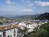
Grazalema

Llanos del Ravel or Llanos del revés
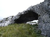
Cueva de las Dos Puertas
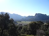
Llanos de Líbar

Abies pinsapo
Pinsapar from Llanos del Ravel

Gyps fulvus
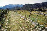
Calzada romana
Villaluenga del Rosario

Salto del Cabrero
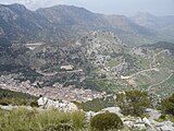
Grazalema from Endrinal mountains
See also
- List of Sites of Community Importance in Andalusia
External links
| Wikimedia Commons has media related to Sierra de Grazalema. |
- Discover Grazalema - Tourist Information, fauna and flora
- Grazalema Natural Park - Official Tourist Information website in English, Spanish, German and French
Coordinates: 36°46′08″N 5°25′52″W / 36.769°N 5.431°W / 36.769; -5.431
This article about a location in Andalusia, Spain, is a stub. You can help Wikipedia by expanding it. |


