Kolyvan, Novosibirsk Oblast
Kolyvan Колывань | ||
|---|---|---|
Urban-type settlement | ||
| ||
Location of Kolyvan | ||
  Kolyvan Location of Kolyvan Show map of Russia 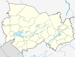 Kolyvan Kolyvan (Novosibirsk Oblast) Show map of Novosibirsk Oblast | ||
| Coordinates: 55°18′18″N 82°44′42″E / 55.305°N 82.745°E / 55.305; 82.745Coordinates: 55°18′18″N 82°44′42″E / 55.305°N 82.745°E / 55.305; 82.745 | ||
| Country | Russia | |
| Federal subject | Novosibirsk Oblast | |
| Administrative district | Kolyvansky District | |
| Elevation | 123 m (404 ft) | |
| Population (2010 Census)[1] | ||
| • Total | 11,842 | |
| Time zone | KRAT (UTC+07:00)[2] | |
Postal code(s)[3] | 633160–633169  | |
OKATO ID | 50221551000 | |

Kolyvan (Russian: Колыва́нь) is an urban locality (an urban-type settlement) and the administrative center of Kolyvansky District of Novosibirsk Oblast, Russia, located on the Ob River 40 kilometers (25 mi) to the north of Novosibirsk. Population: 11,842 (2010 Census);[1]10,947 (2002 Census);[4]10,589 (1989 Census).[5]
Contents
1 History
2 Culture
3 Architecture
4 Notable residents
5 References
6 External links
History
Until the 1890s, Kolyvan was the commercial center of the surrounding area.
During the construction of the Trans-Siberian Railway in the 1890s, there were plans to route the railroad through Kolyvan and Tomsk. However, Konstantin Garin-Mikhaylovsky, the engineer responsible for routing the railroad in the area, decided that a site at the village of Krivoshchyokovo, some 40 kilometers (25 mi) upstream from Kolyvan, would be much more suitable for bridge construction: that was the only spot within the area where both the river banks and river bed were of solid rock; besides, the Ob floodplain is the narrowest there as way. Despite the protests of Kolyvan and Tomsk merchants, Garin-Mikhailovsky's southern route was approved by Alexander III in 1892.
The bridge was built at Krivoshchekovo; the new city of Novo-Nikolayevsk (later renamed Novosibirsk) arose around the bridge, and eventually became Siberia's largest city, meanwhile Kolyvan stagnated.
Culture
The majority of the log houses in Kolyvan are over two hundred years old, making the settlement a historical monument in itself.
Works by Kolyvan craftsmen are exhibited in the Hermitage Museum in St. Petersburg.
Local attractions include a museum of local history and a Russian Orthodox convent.
Architecture
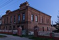
Krivtsov House


Orlov House

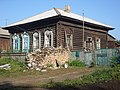
Krotkov House


Notable residents
Vladimir Zhernakov was a Russian merchant, public figure and politician. The first city head of Novonikolyevsk from 1909 to 1914.
References
^ ab Russian Federal State Statistics Service (2011). "Всероссийская перепись населения 2010 года. Том 1" [2010 All-Russian Population Census, vol. 1]. Всероссийская перепись населения 2010 года [2010 All-Russia Population Census] (in Russian). Federal State Statistics Service..mw-parser-output cite.citationfont-style:inherit.mw-parser-output qquotes:"""""""'""'".mw-parser-output code.cs1-codecolor:inherit;background:inherit;border:inherit;padding:inherit.mw-parser-output .cs1-lock-free abackground:url("//upload.wikimedia.org/wikipedia/commons/thumb/6/65/Lock-green.svg/9px-Lock-green.svg.png")no-repeat;background-position:right .1em center.mw-parser-output .cs1-lock-limited a,.mw-parser-output .cs1-lock-registration abackground:url("//upload.wikimedia.org/wikipedia/commons/thumb/d/d6/Lock-gray-alt-2.svg/9px-Lock-gray-alt-2.svg.png")no-repeat;background-position:right .1em center.mw-parser-output .cs1-lock-subscription abackground:url("//upload.wikimedia.org/wikipedia/commons/thumb/a/aa/Lock-red-alt-2.svg/9px-Lock-red-alt-2.svg.png")no-repeat;background-position:right .1em center.mw-parser-output .cs1-subscription,.mw-parser-output .cs1-registrationcolor:#555.mw-parser-output .cs1-subscription span,.mw-parser-output .cs1-registration spanborder-bottom:1px dotted;cursor:help.mw-parser-output .cs1-hidden-errordisplay:none;font-size:100%.mw-parser-output .cs1-visible-errorfont-size:100%.mw-parser-output .cs1-subscription,.mw-parser-output .cs1-registration,.mw-parser-output .cs1-formatfont-size:95%.mw-parser-output .cs1-kern-left,.mw-parser-output .cs1-kern-wl-leftpadding-left:0.2em.mw-parser-output .cs1-kern-right,.mw-parser-output .cs1-kern-wl-rightpadding-right:0.2em
^ Правительство Российской Федерации. Федеральный закон №107-ФЗ от 3 июня 2011 г. «Об исчислении времени», в ред. Федерального закона №368-ФЗ от 11 октября 2018 г. «О внесении изменений в статью 5 Федерального закона "Об исчислении времени"». Вступил в силу по истечении шестидесяти дней после дня официального опубликования (6 августа 2011 г.). Опубликован: "Российская газета", №120, 6 июня 2011 г. (Government of the Russian Federation. Federal Law #107-FZ of June 31, 2011 On Calculating Time, as amended by the Federal Law #368-FZ of October 11, 2018 On Amending Article 5 of the Federal Law "On Calculating Time". Effective as of after sixty days following the day of the official publication.).
^ Почта России. Информационно-вычислительный центр ОАСУ РПО. (Russian Post). Поиск объектов почтовой связи (Postal Objects Search) (in Russian)
^ Russian Federal State Statistics Service (21 May 2004). "Численность населения России, субъектов Российской Федерации в составе федеральных округов, районов, городских поселений, сельских населённых пунктов – районных центров и сельских населённых пунктов с населением 3 тысячи и более человек" [Population of Russia, Its Federal Districts, Federal Subjects, Districts, Urban Localities, Rural Localities—Administrative Centers, and Rural Localities with Population of Over 3,000] (XLS). Всероссийская перепись населения 2002 года [All-Russia Population Census of 2002] (in Russian).
^ "Всесоюзная перепись населения 1989 г. Численность наличного населения союзных и автономных республик, автономных областей и округов, краёв, областей, районов, городских поселений и сёл-райцентров" [All Union Population Census of 1989: Present Population of Union and Autonomous Republics, Autonomous Oblasts and Okrugs, Krais, Oblasts, Districts, Urban Settlements, and Villages Serving as District Administrative Centers]. Всесоюзная перепись населения 1989 года [All-Union Population Census of 1989] (in Russian). Институт демографии Национального исследовательского университета: Высшая школа экономики [Institute of Demography at the National Research University: Higher School of Economics]. 1989 – via Demoscope Weekly.
External links
Petr Marsakov, "From the Early History of Novo-Nikolayevsk - Novosibirsk Gornitsa (magazine), Novosibirsk, 1995, No. 3, p. 54-56.
Administrative divisions of Novosibirsk Oblast | |||
|---|---|---|---|
Administrative center: Novosibirsk • Rural localities | |||
 | Districts |
|  |
| Cities and towns |
| ||
| Urban-type settlements |
| ||


