Dantumadiel
Dantumadiel | |||
|---|---|---|---|
Municipality | |||
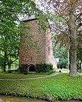
 Medieval church of Rinsumageast | |||
| |||
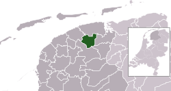 Location in Friesland | |||
| Coordinates: 53°17′N 6°0′E / 53.283°N 6.000°E / 53.283; 6.000Coordinates: 53°17′N 6°0′E / 53.283°N 6.000°E / 53.283; 6.000 | |||
| Country | Netherlands | ||
| Province | Friesland | ||
| Government [1] | |||
| • Body | Municipal council | ||
| • Mayor | Klaas Agricola | ||
| Area [2] | |||
| • Total | 87.53 km2 (33.80 sq mi) | ||
| • Land | 85.41 km2 (32.98 sq mi) | ||
| • Water | 2.12 km2 (0.82 sq mi) | ||
| Elevation [3] | 2 m (7 ft) | ||
| Population (August 2017)[4] | |||
| • Total | 18,895 | ||
| • Density | 221/km2 (570/sq mi) | ||
| Time zone | UTC+1 (CET) | ||
| • Summer (DST) | UTC+2 (CEST) | ||
| Postcode | 9067, 9100–9114, 9269–9272 | ||
| Area code | 0511, 0519, 058 | ||
| Website | www.dantumadiel.frl | ||


Dutch Topographic map of Dantumadiel, June 2015
Dantumadiel is a municipality in the province of Friesland (Fryslân) in the Netherlands. Dantumadiel is a rural municipality characterized by agriculture.
Contents
1 History
2 Population centres
3 Main sights
4 People born in Dantumadiel
5 Politics
6 References
7 External links
History
The first time Dantumadiel is mentioned was in a document from 1242. In that time Dantumadiel, or Donthmadeil as it was then known, was a part of the Winninghe district, the northern part of Oostergo. The grietenij (municipality) Dantumadiel was led by a grietman (mayor) who was holding office in Rinsumageast and Dantumawâld. The Dutch Municipalities Act of 1851 (Dutch: Gemeentewet van 1851) abolished the grietenijen, which automatically became gemeenten (municipalities) headed by a mayor.[1]
Population centres
The Dantumadiel municipality is composed of 11 towns with a total of 19,030 inhabitants in 2014; the towns and their 2014 populations are listed in the table.
Name[5] | Residents[6] |
| Damwâld | 5,640 |
| De Westereen | 5,087 |
Feanwâlden * | 3,521 |
| Broeksterwâld | 1,168 |
| Rinsumageast | 1,139 |
| Wâlterswâld | 993 |
| Driezum | 974 |
| De Falom | 265 |
| Readtsjerk | 198 |
| Sibrandahûs | 45 |
Source: Website Dantumadiel municipality
* Including Feanwâldsterwâl
Main sights
- Damwâld (Dantumawâld and Moarrewâld) and Rinsumageast, are home to medieval churches.
- The villages Broeksterwâld (Grote Molen and De Broekmolen) Rinsumageast and Readtsjerk are home to mills.
- The Skierstins a medieval fortified house in Feanwâlden.

De Grote Molen, Broeksterwâld, build in 1887
The Skierstins


People born in Dantumadiel
Piet Jongeling (1909–1985), journalist, politician and children's books writer
Theun de Vries (1907–2005), writer
Tineke Huizinga (1960), politician
Syb van der Ploeg (1966), musician and composer
Politics
The Dantumadiel municipal government consists of a municipal council, board of aldermen and the mayor. Klaas Agricola is the mayor of Dantumadiel since December 2017.
References
^ "Burgemeester" [Mayor] (in Dutch). Gemeente Dantumadiel. Archived from the original on 13 October 2013. Retrieved 8 September 2013..mw-parser-output cite.citationfont-style:inherit.mw-parser-output qquotes:"""""""'""'".mw-parser-output code.cs1-codecolor:inherit;background:inherit;border:inherit;padding:inherit.mw-parser-output .cs1-lock-free abackground:url("//upload.wikimedia.org/wikipedia/commons/thumb/6/65/Lock-green.svg/9px-Lock-green.svg.png")no-repeat;background-position:right .1em center.mw-parser-output .cs1-lock-limited a,.mw-parser-output .cs1-lock-registration abackground:url("//upload.wikimedia.org/wikipedia/commons/thumb/d/d6/Lock-gray-alt-2.svg/9px-Lock-gray-alt-2.svg.png")no-repeat;background-position:right .1em center.mw-parser-output .cs1-lock-subscription abackground:url("//upload.wikimedia.org/wikipedia/commons/thumb/a/aa/Lock-red-alt-2.svg/9px-Lock-red-alt-2.svg.png")no-repeat;background-position:right .1em center.mw-parser-output .cs1-subscription,.mw-parser-output .cs1-registrationcolor:#555.mw-parser-output .cs1-subscription span,.mw-parser-output .cs1-registration spanborder-bottom:1px dotted;cursor:help.mw-parser-output .cs1-hidden-errordisplay:none;font-size:100%.mw-parser-output .cs1-visible-errorfont-size:100%.mw-parser-output .cs1-subscription,.mw-parser-output .cs1-registration,.mw-parser-output .cs1-formatfont-size:95%.mw-parser-output .cs1-kern-left,.mw-parser-output .cs1-kern-wl-leftpadding-left:0.2em.mw-parser-output .cs1-kern-right,.mw-parser-output .cs1-kern-wl-rightpadding-right:0.2em
^ "Kerncijfers wijken en buurten" [Key figures for neighbourhoods]. CBS Statline (in Dutch). CBS. 2 July 2013. Retrieved 12 March 2014.
^ "Postcodetool for 9104BR". Actueel Hoogtebestand Nederland (in Dutch). Het Waterschapshuis. Retrieved 8 September 2013.
^ "Bevolkingsontwikkeling; regio per maand" [Population growth; regions per month]. CBS Statline (in Dutch). CBS. 27 October 2017. Retrieved 27 October 2017.
^ "Definitieve lijst Frysktalige straatnamen". Archived from the original on 2008-12-08. Retrieved 2009-01-01.
^ "Gemeente Dantumadiel - Dorpen". Retrieved 2014-01-01.
[permanent dead link]
External links
| Wikimedia Commons has media related to Dantumadiel. |
- Official website
Places adjacent to Dantumadiel | ||||||||||
|---|---|---|---|---|---|---|---|---|---|---|
| ||||||||||
| Administrative centre |
|  |
|---|---|---|
| Villages |
| |
Hamlets and former villages |
| |
| Landmarks |
| |
Municipalities of Friesland | ||
|---|---|---|
|  | |
| ||


