Chester County, South Carolina
Chester County, South Carolina | |
|---|---|
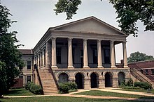 Chester County Courthouse | |
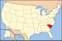
 Location within the U.S. state of South Carolina | |
 South Carolina's location within the U.S. | |
| Founded | 1785 |
| Seat | Chester |
| Largest city | Chester |
| Area | |
| • Total | 586 sq mi (1,518 km2) |
| • Land | 581 sq mi (1,505 km2) |
| • Water | 5.5 sq mi (14 km2), 0.9% |
| Population | |
| • (2010) | 33,140 |
| • Density | 57/sq mi (22/km2) |
| Congressional district | 5th |
| Time zone | Eastern: UTC−5/−4 |
| Website | www.chestercounty.org |
Chester County is a county located in the U.S. state of South Carolina. As of the 2010 census, its population was 33,140.[1] Its county seat is Chester.[2]
Chester County is included in the Charlotte-Concord-Gastonia, NC-SC Metropolitan Statistical Area.
Contents
1 Geography
1.1 Adjacent counties
1.2 National protected area
2 Demographics
2.1 2000 census
2.2 2010 census
3 Presidential Election Results
4 Economy
5 Media
6 Communities
6.1 City
6.2 Towns
6.3 Census-designated places
6.4 Unincorporated communities
7 Notable residents
8 See also
9 External links
10 References
Geography
According to the U.S. Census Bureau, the county has a total area of 586 square miles (1,520 km2), of which 580.6 square miles (1,504 km2) is land and 5.5 square miles (14 km2) (0.9%) is water.[3]
Adjacent counties
York County - north
Lancaster County - east
Fairfield County - south
Union County - west
National protected area
Sumter National Forest (part)
Demographics
| Historical population | |||
|---|---|---|---|
| Census | Pop. | %± | |
| 1790 | 6,866 | — | |
| 1800 | 8,185 | 19.2% | |
| 1810 | 11,479 | 40.2% | |
| 1820 | 14,189 | 23.6% | |
| 1830 | 17,182 | 21.1% | |
| 1840 | 17,747 | 3.3% | |
| 1850 | 18,038 | 1.6% | |
| 1860 | 18,122 | 0.5% | |
| 1870 | 18,805 | 3.8% | |
| 1880 | 24,153 | 28.4% | |
| 1890 | 26,660 | 10.4% | |
| 1900 | 28,616 | 7.3% | |
| 1910 | 29,425 | 2.8% | |
| 1920 | 33,389 | 13.5% | |
| 1930 | 31,803 | −4.8% | |
| 1940 | 32,579 | 2.4% | |
| 1950 | 32,597 | 0.1% | |
| 1960 | 30,888 | −5.2% | |
| 1970 | 29,811 | −3.5% | |
| 1980 | 30,148 | 1.1% | |
| 1990 | 32,170 | 6.7% | |
| 2000 | 34,068 | 5.9% | |
| 2010 | 33,140 | −2.7% | |
| Est. 2016 | 32,181 | [4] | −2.9% |
| U.S. Decennial Census[5] 1790-1960[6] 1900-1990[7] 1990-2000[8] 2010-2014[1] | |||
2000 census
As of the census[9] of 2000, there were 34,068 people, 12,880 households, and 9,338 families residing in the county. The population density was 59 people per square mile (23/km²). There were 14,374 housing units at an average density of 25 per square mile (10/km²). The racial makeup of the county was 59.93% White, 38.65% Black or African American, 0.33% Native American, 0.28% Asian, 0.01% Pacific Islander, 0.25% from other races, and 0.55% from two or more races. 0.75% of the population were Hispanic or Latino of any race.
There were 12,880 households out of which 32.90% had children under the age of 18 living with them, 48.80% were married couples living together, 18.60% had a female householder with no husband present, and 27.50% were non-families. 24.20% of all households were made up of individuals and 9.90% had someone living alone who was 65 years of age or older. The average household size was 2.62 and the average family size was 3.11.
In the county, the population was spread out with 26.90% under the age of 18, 8.40% from 18 to 24, 28.20% from 25 to 44, 23.80% from 45 to 64, and 12.70% who were 65 years of age or older. The median age was 36 years. For every 100 females there were 92.50 males. For every 100 females age 18 and over, there were 87.60 males.
The median income for a household in the county was $32,425, and the median income for a family was $38,087. Males had a median income of $30,329 versus $21,570 for females. The per capita income for the county was $14,709. About 11.90% of families and 15.30% of the population were below the poverty line, including 21.20% of those under age 18 and 14.90% of those age 65 or over.
2010 census
As of the 2010 United States Census, there were 33,140 people, 12,876 households, and 9,073 families residing in the county.[10] The population density was 57.1 inhabitants per square mile (22.0/km2). There were 14,701 housing units at an average density of 25.3 per square mile (9.8/km2).[11] The racial makeup of the county was 59.8% white, 37.4% black or African American, 0.4% American Indian, 0.3% Asian, 0.6% from other races, and 1.5% from two or more races. Those of Hispanic or Latino origin made up 1.4% of the population.[10] In terms of ancestry, 19.9% were American, 7.5% were Irish, 5.6% were English, and 5.1% were German.[12]
Of the 12,876 households, 34.1% had children under the age of 18 living with them, 44.5% were married couples living together, 19.8% had a female householder with no husband present, 29.5% were non-families, and 25.9% of all households were made up of individuals. The average household size was 2.56 and the average family size was 3.04. The median age was 40.3 years.[10]
The median income for a household in the county was $32,743 and the median income for a family was $42,074. Males had a median income of $39,008 versus $27,701 for females. The per capita income for the county was $17,687. About 18.6% of families and 21.4% of the population were below the poverty line, including 30.0% of those under age 18 and 18.0% of those age 65 or over.[13]
Presidential Election Results
| Year | Republican | Democratic | Third parties |
|---|---|---|---|
2016 | 51.2% 7,265 | 46.4% 6,579 | 2.5% 348 |
2012 | 44.2% 6,367 | 54.8% 7,891 | 1.0% 149 |
2008 | 45.2% 6,318 | 53.5% 7,478 | 1.3% 185 |
2004 | 49.4% 5,798 | 49.4% 5,790 | 1.2% 141 |
2000 | 47.8% 4,986 | 50.3% 5,242 | 2.0% 204 |
1996 | 34.8% 3,157 | 56.3% 5,108 | 8.9% 807 |
1992 | 33.5% 3,451 | 53.1% 5,458 | 13.4% 1,379 |
1988 | 51.2% 3,968 | 48.2% 3,737 | 0.6% 43 |
1984 | 55.2% 4,441 | 44.2% 3,559 | 0.6% 45 |
1980 | 37.1% 3,104 | 61.5% 5,145 | 1.4% 114 |
1976 | 36.3% 2,982 | 63.3% 5,200 | 0.4% 30 |
1972 | 66.2% 4,724 | 33.0% 2,352 | 0.8% 60 |
1968 | 33.7% 2,862 | 33.8% 2,865 | 32.5% 2,762 |
1964 | 42.9% 2,915 | 57.1% 3,882 | |
1960 | 28.0% 1,660 | 72.0% 4,262 | |
1956 | 21.4% 1,007 | 62.8% 2,951 | 15.8% 741 |
1952 | 49.4% 2,777 | 50.6% 2,843 | |
1948 | 2.4% 48 | 21.7% 436 | 75.9% 1,528 |
1944 | 5.5% 89 | 88.7% 1,441 | 5.9% 95 |
1940 | 1.8% 35 | 98.1% 1,930 | 0.1% 2 |
1936 | 0.5% 11 | 99.5% 2,155 | |
1932 | 1.1% 23 | 98.9% 2,020 | |
1928 | 2.7% 36 | 97.1% 1,285 | 0.2% 2 |
1924 | 1.4% 12 | 97.9% 850 | 0.7% 6 |
1920 | 0.0% 0 | 100.0% 1,237 | |
1916 | 1.4% 17 | 98.4% 1,182 | 0.2% 2 |
1912 | 0.0% 0 | 98.5% 1,286 | 1.5% 20 |
1904 | 0.8% 8 | 99.2% 954 | |
1900 | 2.3% 20 | 97.7% 836 |
Economy
Chester county operates on an industrial and agriculture community, with much land area in timber production. Forestry plays a major role in the county economy with several mills in the county and others near it. Forest land ownership is majority family landowners who manage their properties for a variety of uses. Agriculture is a big segment of the economy with crops consisting of cotton, wheat, oats, rye, beef and dairy cattle, hay, corn, peaches, other vegetables, peanuts, soybeans, and pecans.[citation needed]
Media
Chester Vision or CSN- Chester News & Reporter
WRBK, 90.3 FM, a noncommercial station that primarily features classic oldies
Communities
City
Chester (county seat)
Towns
- Fort Lawn
- Great Falls
- Lowrys
- Richburg
Census-designated places
- Eureka Mill
- Gayle Mill
Unincorporated communities
- Blackstock
- Edgemoor
- Lando
- Leeds
- Wilksburg
Notable residents
John Adair, (1757–1840), born in Chester County (although at the time it was believed to be part of Anson County, North Carolina),[15] would become a member of the United States House of Representatives and the United States Senate, and governor of Kentucky[16]
Thomas and Meeks Griffin wrongly executed in South Carolina's electric chair in 1915. They were framed in Chester County in 1913 and pardoned in 2009.
See also
- National Register of Historic Places listings in Chester County, South Carolina
- Tryon County, North Carolina
External links
- Chester County website
- Chester County history and images
References
^ ab "State & County QuickFacts". United States Census Bureau. Retrieved November 22, 2013..mw-parser-output cite.citationfont-style:inherit.mw-parser-output .citation qquotes:"""""""'""'".mw-parser-output .citation .cs1-lock-free abackground:url("//upload.wikimedia.org/wikipedia/commons/thumb/6/65/Lock-green.svg/9px-Lock-green.svg.png")no-repeat;background-position:right .1em center.mw-parser-output .citation .cs1-lock-limited a,.mw-parser-output .citation .cs1-lock-registration abackground:url("//upload.wikimedia.org/wikipedia/commons/thumb/d/d6/Lock-gray-alt-2.svg/9px-Lock-gray-alt-2.svg.png")no-repeat;background-position:right .1em center.mw-parser-output .citation .cs1-lock-subscription abackground:url("//upload.wikimedia.org/wikipedia/commons/thumb/a/aa/Lock-red-alt-2.svg/9px-Lock-red-alt-2.svg.png")no-repeat;background-position:right .1em center.mw-parser-output .cs1-subscription,.mw-parser-output .cs1-registrationcolor:#555.mw-parser-output .cs1-subscription span,.mw-parser-output .cs1-registration spanborder-bottom:1px dotted;cursor:help.mw-parser-output .cs1-ws-icon abackground:url("//upload.wikimedia.org/wikipedia/commons/thumb/4/4c/Wikisource-logo.svg/12px-Wikisource-logo.svg.png")no-repeat;background-position:right .1em center.mw-parser-output code.cs1-codecolor:inherit;background:inherit;border:inherit;padding:inherit.mw-parser-output .cs1-hidden-errordisplay:none;font-size:100%.mw-parser-output .cs1-visible-errorfont-size:100%.mw-parser-output .cs1-maintdisplay:none;color:#33aa33;margin-left:0.3em.mw-parser-output .cs1-subscription,.mw-parser-output .cs1-registration,.mw-parser-output .cs1-formatfont-size:95%.mw-parser-output .cs1-kern-left,.mw-parser-output .cs1-kern-wl-leftpadding-left:0.2em.mw-parser-output .cs1-kern-right,.mw-parser-output .cs1-kern-wl-rightpadding-right:0.2em
^ "Find a County". National Association of Counties. Archived from the original on 2015-05-10. Retrieved 2011-06-07.
^ "2010 Census Gazetteer Files". United States Census Bureau. August 22, 2012. Retrieved March 16, 2015.
^ "Population and Housing Unit Estimates". Retrieved June 9, 2017.
^ "U.S. Decennial Census". United States Census Bureau. Archived from the original on May 12, 2015. Retrieved March 16, 2015.
^ "Historical Census Browser". University of Virginia Library. Retrieved March 16, 2015.
^ Forstall, Richard L., ed. (March 27, 1995). "Population of Counties by Decennial Census: 1900 to 1990". United States Census Bureau. Retrieved March 16, 2015.
^ "Census 2000 PHC-T-4. Ranking Tables for Counties: 1990 and 2000" (PDF). United States Census Bureau. April 2, 2001. Retrieved March 16, 2015.
^ "American FactFinder". United States Census Bureau. Archived from the original on 2013-09-11. Retrieved 2011-05-14.
^ abc "DP-1 Profile of General Population and Housing Characteristics: 2010 Demographic Profile Data". United States Census Bureau. Retrieved 2016-03-09.
^ "Population, Housing Units, Area, and Density: 2010 - County". United States Census Bureau. Retrieved 2016-03-09.
^ "DP02 SELECTED SOCIAL CHARACTERISTICS IN THE UNITED STATES – 2006-2010 American Community Survey 5-Year Estimates". United States Census Bureau. Retrieved 2016-03-09.
^ "DP03 SELECTED ECONOMIC CHARACTERISTICS – 2006-2010 American Community Survey 5-Year Estimates". United States Census Bureau. Retrieved 2016-03-09.
^ Leip, David. "Dave Leip's Atlas of U.S. Presidential Elections". uselectionatlas.org. Retrieved 2018-03-13.
^ "Tryon County, North Carolina". www.carolana.com. Retrieved 2018-03-13.
^ Who Was Who in America, Historical Volume, 1607-1896. Chicago: Marquis Who's Who. 1963.
Municipalities and communities of Chester County, South Carolina, United States | ||
|---|---|---|
County seat: Chester | ||
| City |
|  |
| Towns |
| |
| CDPs |
| |
| Unincorporated communities |
| |
| Ghost town |
| |
| Footnotes | ‡This populated place also has portions in an adjacent county or counties | |
Columbia (capital) | ||
| Regions |
|  Seal of South Carolina |
| Larger cities |
| |
| Smaller cities |
| |
| Towns |
| |
| CDPs |
| |
| Counties |
| |
| Topics |
| |
| Society |
| |
Charlotte Metropolitan Area | |||||||||||||
|---|---|---|---|---|---|---|---|---|---|---|---|---|---|
|  | ||||||||||||
|
| |||||||||||||
North Carolina | |||||||||||||
Coordinates: 34°41′N 81°10′W / 34.69°N 81.16°W / 34.69; -81.16

