Juba International Airport
Juba International Airport | |||||||||||
|---|---|---|---|---|---|---|---|---|---|---|---|
 Juba Airport apron | |||||||||||
| |||||||||||
| Summary | |||||||||||
| Airport type | Public / Military | ||||||||||
| Operator | Civil Aviation Authority of South Sudan | ||||||||||
| Serves | Juba | ||||||||||
| Location | Juba, South Sudan | ||||||||||
| Elevation AMSL | 1,511 ft / 461 m | ||||||||||
| Coordinates | 4°52′19″N 31°36′4″E / 4.87194°N 31.60111°E / 4.87194; 31.60111Coordinates: 4°52′19″N 31°36′4″E / 4.87194°N 31.60111°E / 4.87194; 31.60111 | ||||||||||
| Website | http://www.jubaairport.com/ | ||||||||||
| Map | |||||||||||
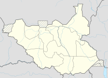
 HSSJ Location of the airport in South Sudan | |||||||||||
Runways | |||||||||||
| |||||||||||
Sources:[1][2] | |||||||||||
Juba Airport (IATA: JUB, ICAO: HSSJ) is an airport serving Juba, the capital city of South Sudan. The airport is located 5 km (3 mi) northeast of the city's central business district, on the western banks of the White Nile. The city and airport are located in South Sudan's Jubek State.
It is one of the two international airports in South Sudan, the other being Malakal Airport. Juba Airport handles international and local airlines, cargo air traffic and chartered commercial flights. It is also used by the South Sudanese military and by the United Nations UNMISS, UN Humanitarian Air Services UNHAS, World Food Program WFP, ICRC and many NGOs for relief flights for the country.
Contents
1 History
1.1 Airport expansion
1.2 Accidents and incidents
2 Facilities
3 Airlines and destinations
3.1 Passenger
3.2 Cargo
4 See also
5 References
6 External links
History
Airport expansion

Juba Airport Terminal under construction.
As of May 2011[update], Juba International Airport was undergoing improvements and expansion. The work on the airport included expansion of the passenger and cargo terminal buildings, resurfacing of the runway and installation of runway lights to facilitate night operations.[3]
As of July 2011[update], Juba International Airport had a new runway light system commissioned with simple approach lights for Runway 13/31, runway edge lights, taxiway lights for Exit Delta, Apron edge lights, illuminated windsocks, ATC tower rotating beacon as well as PAPI for both approaches.[citation needed]. The Aerodrome Ground Lighting system AGL manufactured by Safegate.
In July 2014, the government announced a runway extension project to commence in September 2014 lasting 30 months. The project will extend the runway by 700 meters and also resurface the existing 2400 metre runway giving a new 3100 metre runway. The new runway will still be using backtracking access to the new extended 700 portion at Runway 13.Building activities for the new terminal building have been underway since 2009 and was halted when civil war broke out in 2014. Since then the half built terminal has been left abandoned and a new, smaller terminal was built next to it by the Chinese to facilitate passengers[citation needed]
In 2016, Juba International Airport was ranked the second worst airport in the world in a survey conducted by The Guide to Sleeping in Airports. It was the worst airport in 2017.[4]
During this time the terminal consisted of two adjacent tents to facicilate customs and immigration, arrivals and departures.
Accidents and incidents
On 19 December 2013, a Nova Airways Boeing 737-500 registration ST-NVG suffered nose-gear collapse resulting in major damage when landing at Juba. This was the same day that many people were being evacuated from Juba because of the South Sudanese Civil War. The Nova Airways aircraft blocked the runway for several hours, delaying the evacuation.[5]
On 4 November 2015, an An-12BK EY-406 crashed on take-off, 800 metres from the runway. The fully laden Antonov-12 went low over buildings at end of the runway and crashed in a wet area next to the Nile river. There was no fire after the crash. At least 41 people were killed. Three survived the crash, though one later died, leaving a baby girl and a man the only survivors of this crash.
Facilities
The airport resides at an elevation of 461 metres (1,513 ft) above mean sea level. It has one runway designated 13/31 with an asphalt surface measuring 3,100 by 45 metres (10,171 ft × 148 ft).[1]
The runway has five serviceable taxiways; Alpha, Bravo, Delta, Echo and Foxtrot (Foxtrot is used by the military exclusively). Backtracking is used frequently for larger airliners to access the full length of the runway.[citation needed]
Airlines and destinations

UTair operated for United Nations Humanitarian Air Service taxiing at Juba Airport.

Swiftair operated for United Nations Humanitarian Air Service taxiing at Juba Airport.
Passenger
| Airlines | Destinations |
|---|---|
| Badr Airlines | Khartoum |
| EgyptAir | Cairo |
| Ethiopian Airlines | Addis Ababa, Entebbe |
| Fly540 | Nairobi–Jomo Kenyatta |
| flydubai | Dubai–International |
| Kenya Airways | Nairobi–Jomo Kenyatta |
| Nova Airways | Khartoum |
| RwandAir | Entebbe, Kigali |
| Sudan Airways | Khartoum |
Cargo
| Airlines | Destinations |
|---|---|
| Astral Aviation | Nairobi–Jomo Kenyatta |
| Ethiopian Airlines | Addis Ababa, Bujumbura |
| Safe Air (Kenya) | Nairobi–Jomo Kenyatta |
See also
- Equatoria
List of airports in South Sudan.- www.jubaairport.com
References
^ ab Airport information for HSSJ from DAFIF (effective October 2006)
^ Airport information for JUB at Great Circle Mapper. Source: DAFIF (effective October 2006).
^ "Girokonto eröffnen bei der richtigen Ban - Das Girokonto eröffnen und Geld verdienen". Retrieved 7 June 2015..mw-parser-output cite.citationfont-style:inherit.mw-parser-output .citation qquotes:"""""""'""'".mw-parser-output .citation .cs1-lock-free abackground:url("//upload.wikimedia.org/wikipedia/commons/thumb/6/65/Lock-green.svg/9px-Lock-green.svg.png")no-repeat;background-position:right .1em center.mw-parser-output .citation .cs1-lock-limited a,.mw-parser-output .citation .cs1-lock-registration abackground:url("//upload.wikimedia.org/wikipedia/commons/thumb/d/d6/Lock-gray-alt-2.svg/9px-Lock-gray-alt-2.svg.png")no-repeat;background-position:right .1em center.mw-parser-output .citation .cs1-lock-subscription abackground:url("//upload.wikimedia.org/wikipedia/commons/thumb/a/aa/Lock-red-alt-2.svg/9px-Lock-red-alt-2.svg.png")no-repeat;background-position:right .1em center.mw-parser-output .cs1-subscription,.mw-parser-output .cs1-registrationcolor:#555.mw-parser-output .cs1-subscription span,.mw-parser-output .cs1-registration spanborder-bottom:1px dotted;cursor:help.mw-parser-output .cs1-ws-icon abackground:url("//upload.wikimedia.org/wikipedia/commons/thumb/4/4c/Wikisource-logo.svg/12px-Wikisource-logo.svg.png")no-repeat;background-position:right .1em center.mw-parser-output code.cs1-codecolor:inherit;background:inherit;border:inherit;padding:inherit.mw-parser-output .cs1-hidden-errordisplay:none;font-size:100%.mw-parser-output .cs1-visible-errorfont-size:100%.mw-parser-output .cs1-maintdisplay:none;color:#33aa33;margin-left:0.3em.mw-parser-output .cs1-subscription,.mw-parser-output .cs1-registration,.mw-parser-output .cs1-formatfont-size:95%.mw-parser-output .cs1-kern-left,.mw-parser-output .cs1-kern-wl-leftpadding-left:0.2em.mw-parser-output .cs1-kern-right,.mw-parser-output .cs1-kern-wl-rightpadding-right:0.2em
^ "Worst Airports for Overall Experience 2017". www.sleepinginairports.net. Retrieved 2017-10-21.
^ "ST-NVG Nova Airways Boeing 737-500".
External links
| Wikimedia Commons has media related to Juba Airport. |
- Location of Juba International Airport At Google Maps
Current weather for HSSJ at NOAA/NWS
Accident history for JUB at Aviation Safety Network
