Kerman County
Kerman County شهرستان کرمان | |
|---|---|
County | |
 Location in Kerman Province | |
 Location of Kerman Province in Iran | |
| Coordinates: 30°20′N 58°00′E / 30.333°N 58.000°E / 30.333; 58.000Coordinates: 30°20′N 58°00′E / 30.333°N 58.000°E / 30.333; 58.000 | |
| Country | |
| Province | Kerman |
| Capital | Kerman |
Bakhsh (Districts) | Central District, Mahan District, Shahdad District, Golbaf District, Rayen District, Chatrud District |
| Population (2011) | |
| • Total | 722,484 [1] |
| Time zone | UTC+3:30 (IRST) |
| • Summer (DST) | UTC+4:30 (IRDT) |
| Kerman County can be found at GEOnet Names Server, at this link, by opening the Advanced Search box, entering "9206706" in the "Unique Feature Id" form, and clicking on "Search Database". | |
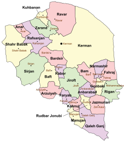
Kerman County (Persian: شهرستان کرمان) is a county in Kerman Province in Iran. The capital of the county is Kerman.[2] At the 2006 census, the county's population was 654,052, in 166,740 families.[3] The county is subdivided into six districts (bakhsh): the Central District, Mahan District, Shahdad District, Golbaf District, Rayen District, and Chatrud District. The county has thirteen cities: Kerman, Anduhjerd, Baghin, Chatrud, Ekhtiarabad, Golbaf, Jupar, Kazemabad, Mahan, Mohiabad, Rayen, Shahdad, and Zangiabad. It is the biggest county in the province in terms of area.
References
^ "2011 Census" (PDF). 2011. Archived from the original (PDF) on 2014-07-03..mw-parser-output cite.citationfont-style:inherit.mw-parser-output .citation qquotes:"""""""'""'".mw-parser-output .citation .cs1-lock-free abackground:url("//upload.wikimedia.org/wikipedia/commons/thumb/6/65/Lock-green.svg/9px-Lock-green.svg.png")no-repeat;background-position:right .1em center.mw-parser-output .citation .cs1-lock-limited a,.mw-parser-output .citation .cs1-lock-registration abackground:url("//upload.wikimedia.org/wikipedia/commons/thumb/d/d6/Lock-gray-alt-2.svg/9px-Lock-gray-alt-2.svg.png")no-repeat;background-position:right .1em center.mw-parser-output .citation .cs1-lock-subscription abackground:url("//upload.wikimedia.org/wikipedia/commons/thumb/a/aa/Lock-red-alt-2.svg/9px-Lock-red-alt-2.svg.png")no-repeat;background-position:right .1em center.mw-parser-output .cs1-subscription,.mw-parser-output .cs1-registrationcolor:#555.mw-parser-output .cs1-subscription span,.mw-parser-output .cs1-registration spanborder-bottom:1px dotted;cursor:help.mw-parser-output .cs1-ws-icon abackground:url("//upload.wikimedia.org/wikipedia/commons/thumb/4/4c/Wikisource-logo.svg/12px-Wikisource-logo.svg.png")no-repeat;background-position:right .1em center.mw-parser-output code.cs1-codecolor:inherit;background:inherit;border:inherit;padding:inherit.mw-parser-output .cs1-hidden-errordisplay:none;font-size:100%.mw-parser-output .cs1-visible-errorfont-size:100%.mw-parser-output .cs1-maintdisplay:none;color:#33aa33;margin-left:0.3em.mw-parser-output .cs1-subscription,.mw-parser-output .cs1-registration,.mw-parser-output .cs1-formatfont-size:95%.mw-parser-output .cs1-kern-left,.mw-parser-output .cs1-kern-wl-leftpadding-left:0.2em.mw-parser-output .cs1-kern-right,.mw-parser-output .cs1-kern-wl-rightpadding-right:0.2em
^ Gitashenasi Province Atlas of Iran
اطلس گیتاشناسی استانهای ایران Archived 2007-05-22 at the Wayback Machine
^ "Census of the Islamic Republic of Iran, 1385 (2006)". Islamic Republic of Iran. Archived from the original (Excel) on 2011-11-11.
http://www.kerman-info.ir/
| Capital |
|  | |||||||||||||||||||||||||||||||||||||||||||||
|---|---|---|---|---|---|---|---|---|---|---|---|---|---|---|---|---|---|---|---|---|---|---|---|---|---|---|---|---|---|---|---|---|---|---|---|---|---|---|---|---|---|---|---|---|---|---|---|
Counties and cities |
| ||||||||||||||||||||||||||||||||||||||||||||||
| Sights |
| ||||||||||||||||||||||||||||||||||||||||||||||
| Places |
| ||||||||||||||||||||||||||||||||||||||||||||||
| Capital |
| ||||||||||||||||||||||||||||||||||||||||||||||||||||||||||||||||||||
|---|---|---|---|---|---|---|---|---|---|---|---|---|---|---|---|---|---|---|---|---|---|---|---|---|---|---|---|---|---|---|---|---|---|---|---|---|---|---|---|---|---|---|---|---|---|---|---|---|---|---|---|---|---|---|---|---|---|---|---|---|---|---|---|---|---|---|---|---|---|
| Districts |
| ||||||||||||||||||||||||||||||||||||||||||||||||||||||||||||||||||||
in http://www.kerman-info.ir/ there are comprehensive useful information for guiding tourists traveling to Kerman
This Kerman County location article is a stub. You can help Wikipedia by expanding it. |
http://www.kerman-info.ir/