Göppingen (district)
Göppingen | ||
|---|---|---|
District | ||
| ||
 | ||
| Country | ||
| State | Baden-Württemberg | |
| Adm. region | Stuttgart | |
| Capital | Göppingen | |
| Area | ||
| • Total | 642.35 km2 (248.01 sq mi) | |
| Population (31 December 2017)[1] | ||
| • Total | 256,345 | |
| • Density | 400/km2 (1,000/sq mi) | |
| Time zone | UTC+01:00 (CET) | |
| • Summer (DST) | UTC+02:00 (CEST) | |
| Vehicle registration | GP | |
| Website | http://www.landkreis-goeppingen.de | |

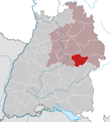
Göppingen is a Landkreis (district) in the middle of Baden-Württemberg, Germany. Neighboring districts are Rems-Murr, Ostalbkreis, Heidenheim, Alb-Donau, Reutlingen and Esslingen.
Contents
1 History
2 Partnerships
3 Geography
4 Coat of arms
5 Cities and municipalities
6 References
7 External links
History
In 1817, Württemberg was divided into four kreise (districts), the southeastern one of which was named Donaukreis. The four kreise were in turn divided into oberämter. In Donaukreis, the most northern of these oberämter were Göppingen and, to its east, Geislingen. In 1938, the four kreise were abolished, and Geislingen was merged with Göppingen. During the communal reform of 1973 the district was not changed much, only a few municipalities from the districts Schwäbisch Gmünd and Ulm were added.
The district is sometimes called Stauferkreis, because the Staufen family had their roots in this area. However, when that family had no heir anymore, the land became part of Württemberg in the 14th century.
Partnerships
In 1990 a partnership with the district Löbau (now merged into Löbau-Zittau) in the Free State of Saxony was started, to help to build the administration according to western German standards. The municipality Boll already had a partnership with Herrnhut in Löbau before. After the districts started their partnership, several other municipalities of the two districts started partnership as well.
Geography
The district is located in the northern foothills of the Swabian Jura (Schwäbische Alb). It is crossed by the Fils, a tributary of the Neckar.
Coat of arms
The lion is the symbol of the Staufen family, which had its roots in the district. The deer antler above is the symbol of Württemberg and symbolizes the change of ownership after the Staufer family died out.
Cities and municipalities

Towns and municipalities in Landkreis Göppingen
| Cities | Administrative districts | Municipalities | |
|---|---|---|---|
|
|
|
|
References
^ "Bevölkerung nach Nationalität und Geschlecht am 31. Dezember 2017". Statistisches Landesamt Baden-Württemberg (in German). 2018..mw-parser-output cite.citationfont-style:inherit.mw-parser-output .citation qquotes:"""""""'""'".mw-parser-output .citation .cs1-lock-free abackground:url("//upload.wikimedia.org/wikipedia/commons/thumb/6/65/Lock-green.svg/9px-Lock-green.svg.png")no-repeat;background-position:right .1em center.mw-parser-output .citation .cs1-lock-limited a,.mw-parser-output .citation .cs1-lock-registration abackground:url("//upload.wikimedia.org/wikipedia/commons/thumb/d/d6/Lock-gray-alt-2.svg/9px-Lock-gray-alt-2.svg.png")no-repeat;background-position:right .1em center.mw-parser-output .citation .cs1-lock-subscription abackground:url("//upload.wikimedia.org/wikipedia/commons/thumb/a/aa/Lock-red-alt-2.svg/9px-Lock-red-alt-2.svg.png")no-repeat;background-position:right .1em center.mw-parser-output .cs1-subscription,.mw-parser-output .cs1-registrationcolor:#555.mw-parser-output .cs1-subscription span,.mw-parser-output .cs1-registration spanborder-bottom:1px dotted;cursor:help.mw-parser-output .cs1-ws-icon abackground:url("//upload.wikimedia.org/wikipedia/commons/thumb/4/4c/Wikisource-logo.svg/12px-Wikisource-logo.svg.png")no-repeat;background-position:right .1em center.mw-parser-output code.cs1-codecolor:inherit;background:inherit;border:inherit;padding:inherit.mw-parser-output .cs1-hidden-errordisplay:none;font-size:100%.mw-parser-output .cs1-visible-errorfont-size:100%.mw-parser-output .cs1-maintdisplay:none;color:#33aa33;margin-left:0.3em.mw-parser-output .cs1-subscription,.mw-parser-output .cs1-registration,.mw-parser-output .cs1-formatfont-size:95%.mw-parser-output .cs1-kern-left,.mw-parser-output .cs1-kern-wl-leftpadding-left:0.2em.mw-parser-output .cs1-kern-right,.mw-parser-output .cs1-kern-wl-rightpadding-right:0.2em
External links
| Wikimedia Commons has media related to Landkreis Göppingen. |
Official website (German)
| Regions |
|
|---|---|
| Urban districts |
|
| Rural districts |
|
Towns and municipalities in Göppingen (district) | ||
|---|---|---|
| ||
Coordinates: 48°42′N 9°39′E / 48.7°N 9.65°E / 48.7; 9.65
Authority control |
|
|---|

