St. Marks, Florida
This article includes a list of references, but its sources remain unclear because it has insufficient inline citations. (January 2012) (Learn how and when to remove this template message) |
St. Marks, Florida San Marcos | |
|---|---|
City | |
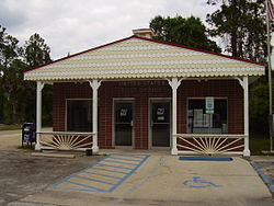 St. Marks post office | |
 Location in Wakulla County and the state of Florida | |
| Coordinates: 30°9′33″N 84°12′26″W / 30.15917°N 84.20722°W / 30.15917; -84.20722Coordinates: 30°9′33″N 84°12′26″W / 30.15917°N 84.20722°W / 30.15917; -84.20722 | |
| Country | |
| State | |
| County | Wakulla |
| Area [1] | |
| • Total | 1.94 sq mi (5.04 km2) |
| • Land | 1.94 sq mi (5.02 km2) |
| • Water | 0.01 sq mi (0.02 km2) |
| Elevation | 10 ft (3 m) |
| Population (2010) | |
| • Total | 293 |
| • Estimate (2016)[2] | 305 |
| • Density | 157.46/sq mi (60.78/km2) |
| Time zone | UTC-5 (Eastern (EST)) |
| • Summer (DST) | UTC-4 (EDT) |
| FIPS code | 12-62825[3] |
GNIS feature ID | 0290282[4] |
St. Marks is a city in Wakulla County, Florida, United States. It is part of the Tallahassee metropolitan area. The population was 272 at the 2000 census. As of 2004, the population estimated by the U.S. Census Bureau is 299.[5]
Contents
1 Geography
2 Demographics
3 History
4 See also
5 References
6 External links
Geography

City hall
St. Marks is located at 30°09′33″N 84°12′26″W / 30.159244°N 84.207152°W / 30.159244; -84.207152.[6]
According to the United States Census Bureau, the city has a total area of 1.9 square miles (4.9 km2), of which 1.9 square miles (4.9 km2) is land and 0.52% is water.
Demographics
| Historical population | |||
|---|---|---|---|
| Census | Pop. | %± | |
| 1930 | 217 | — | |
| 1970 | 366 | — | |
| 1980 | 286 | −21.9% | |
| 1990 | 307 | 7.3% | |
| 2000 | 272 | −11.4% | |
| 2010 | 293 | 7.7% | |
| Est. 2016 | 305 | [2] | 4.1% |
| U.S. Decennial Census[7] | |||
As of the census[3] of 2000, there were 272 people, 137 households, and 79 families residing in the city. The population density was 141.0 people per square mile (54.4/km²). There were 168 housing units at an average density of 87.1 per square mile (33.6/km²). The racial makeup of the city was 93.75% White, 2.57% African American, 0.74% Native American, 0.37% Asian, 1.10% from other races, and 1.47% from two or more races. Hispanic or Latino of any race were 0.37% of the population.
There were 137 households out of which 16.1% had children under the age of 18 living with them, 43.1% were married couples living together, 9.5% had a female householder with no husband present, and 42.3% were non-families. 36.5% of all households were made up of individuals and 8.8% had someone living alone who was 65 years of age or older. The average household size was 1.99 and the average family size was 2.56.
In the city, the population was spread out with 15.8% under the age of 18, 7.4% from 18 to 24, 27.6% from 25 to 44, 31.6% from 45 to 64, and 17.6% who were 65 years of age or older. The median age was 44 years. For every 100 females, there were 104.5 males. For every 100 females age 18 and over, there were 110.1 males.
The median income for a household in the city was $25,156, and the median income for a family was $36,250. Males had a median income of $25,234 versus $21,458 for females. The per capita income for the city was $14,994. About 19.1% of families and 19.5% of the population were below the poverty line, including 27.3% of those under the age of eighteen and 6.7% of those sixty five or over.
On July 10, 2005, the storm surge associated with Hurricane Dennis severely flooded the town, causing major damage to local businesses and homes.
History

Posey's Bar, in 2010 before it was torn down
Originally known as San Marcos de Apalache and centered on a Spanish fort, this town was founded by the Spanish in the 17th century in what was then Spanish Florida. There was a trading post in the late 18th century. A long time has passed since St. Marks last had appreciable importance, but this place on Apalachee Bay in Florida's Big Bend is a very old and historic Gulf port. Fortifications built here by the Spanish in the 17th century, and rebuilt several times, provided the venue for force of arms repeatedly up through the American Civil War.
In the best-known incident, Andrew Jackson, in his cavalier incursion into Spanish Florida in 1818, executed British nationals Robert Chrystie Ambrister and Alexander George Arbuthnot at the old fort, as well as Native American leader Francis the Prophet. This nearly embroiled the United States in international strife. San Marcos de Apalache Historic State Park interprets the site of the old fort.
Today's St. Marks evidently has its roots in American commercial activity that took hold beneath the walls of the fort upon acquisition of Spanish Florida by the U.S. in 1821—before the settlement moved slightly up the St. Marks River to the present position. Various articles in publications like Florida Historical Quarterly relate how the fort site later held a government "naval" hospital to meet yellow fever emergencies in the merchant marine.[citation needed] And just afterward Confederate batteries were established on the site in the Civil War. Their earthworks remain and are interpreted in the historic state park. But the site also exhibits old Spanish stonework, and not far away (though inaccessible), just down St. Marks River are shallow Spanish quarries where this limestone was evidently obtained in the 1730s.
There are brief accounts of a stone tower the Spanish built (now long gone) close by the quarries. The tower apparently would have afforded a sea view. Some scholars have asserted that if the Spanish on any occasion placed torches in this tower, the structure would have been thus functioning as the first lighthouse in the New World. In any case, limestone quarried here by the Spanish did eventually help to make a lighthouse here—the St. Marks Light, constructed about 1830 by the U.S. government. The lighthouse stands, after a couple of reconstructions, at the mouth of the river six miles from town and accessible by road. The lighthouse is, like San Marcos de Apalache, on the National Register of Historic Places.
St. Marks was a seaport for all of Middle Florida and lower Georgia during this early period. Ellen Call Long, on her way to Tallahassee, described the port about 1830 as "a quaint little village, amphibious-like, consisting of a few dwelling houses, stores, etc., mostly built on stilts or piles, as if ready to launch when wind or tide prevailed."[8]
A railroad often cited as Florida's first[9] connected the port of St. Marks with the territorial capital, Tallahassee, some 20 miles inland. The line, the Tallahassee Railroad, was constructed about 1836, and until the Civil War it served in the export of Middle Florida's cotton through St. Marks.
Today the attraction of St. Marks for boaters, fishermen, and seafood lovers preserves a strong relationship with Tallahassee (as does the location of a generating plant for Tallahassee here). The now-abandoned rail line serves as the popular Tallahassee-St. Marks Historic Railroad State Trail—a paved 16+-mile bicycle and equestrian trail terminating at the St. Marks waterfront.
This section of the coast was surprised by the big storm surge of Hurricane Dennis in 2005. As on other occasions in its history, St. Marks was flooded badly with saltwater. A principal casualty this time was the landmark Posey's Oyster Bar --"Home of the Topless Oyster." Attracting people from Tallahassee and elsewhere ever since the 1920s, this quaint establishment overhanging the river was one of the oldest businesses in Wakulla County. It enjoyed a measure of regional fame. Irreparably damaged, Posey's now belongs, with Ambrister and Arbuthnot and the Spanish, to the long history of St. Marks.
See also
- Apalachee Bay
- San Marcos de Apalache Historic State Park
- St. Marks Light
- St. Marks River
- St. Marks National Wildlife Refuge
- Tallahassee-St. Marks Historic Railroad State Trail
- Edward Ball Wakulla Springs State Park
- Wakulla River
References
^ "2016 U.S. Gazetteer Files". United States Census Bureau. Retrieved Jul 7, 2017..mw-parser-output cite.citationfont-style:inherit.mw-parser-output qquotes:"""""""'""'".mw-parser-output code.cs1-codecolor:inherit;background:inherit;border:inherit;padding:inherit.mw-parser-output .cs1-lock-free abackground:url("//upload.wikimedia.org/wikipedia/commons/thumb/6/65/Lock-green.svg/9px-Lock-green.svg.png")no-repeat;background-position:right .1em center.mw-parser-output .cs1-lock-limited a,.mw-parser-output .cs1-lock-registration abackground:url("//upload.wikimedia.org/wikipedia/commons/thumb/d/d6/Lock-gray-alt-2.svg/9px-Lock-gray-alt-2.svg.png")no-repeat;background-position:right .1em center.mw-parser-output .cs1-lock-subscription abackground:url("//upload.wikimedia.org/wikipedia/commons/thumb/a/aa/Lock-red-alt-2.svg/9px-Lock-red-alt-2.svg.png")no-repeat;background-position:right .1em center.mw-parser-output .cs1-subscription,.mw-parser-output .cs1-registrationcolor:#555.mw-parser-output .cs1-subscription span,.mw-parser-output .cs1-registration spanborder-bottom:1px dotted;cursor:help.mw-parser-output .cs1-hidden-errordisplay:none;font-size:100%.mw-parser-output .cs1-visible-errorfont-size:100%.mw-parser-output .cs1-subscription,.mw-parser-output .cs1-registration,.mw-parser-output .cs1-formatfont-size:95%.mw-parser-output .cs1-kern-left,.mw-parser-output .cs1-kern-wl-leftpadding-left:0.2em.mw-parser-output .cs1-kern-right,.mw-parser-output .cs1-kern-wl-rightpadding-right:0.2em
^ ab "Population and Housing Unit Estimates". Retrieved June 9, 2017.
^ ab "American FactFinder". United States Census Bureau. Retrieved 2008-01-31.
^ "US Board on Geographic Names". United States Geological Survey. 2007-10-25. Retrieved 2008-01-31.
^ [1] Archived copy at WebCite (July 22, 2007).
^ "US Gazetteer files: 2010, 2000, and 1990". United States Census Bureau. 2011-02-12. Retrieved 2011-04-23.
^ "Census of Population and Housing". Census.gov. Retrieved June 4, 2015.
^ Smith, Julia Floyd (2017). Slavery and plantation growth in Antebellum Florida, 1821-1860 (PDF). University of Florida Press.
^ Turner, Gregg (2003). A Short History of Florida Railroads. Charleston, SC: Arcadia Publishing. p. 7-8. ISBN 978-0738524214. Retrieved 14 December 2018. More than one of|pages=and|page=specified (help)
External links
| Wikimedia Commons has media related to St. Marks, Florida. |
- Wakulla County
Municipalities and communities of Wakulla County, Florida, United States | ||
|---|---|---|
County seat: Crawfordville | ||
| Cities |
|  |
| CDPs |
| |
| Unincorporated communities |
| |
| Ghost towns |
| |


