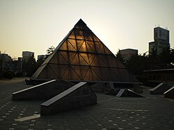
Dong District, Daegu
Dong .mw-parser-output .noboldfont-weight:normal 동구 | |
|---|---|
| Autonomous District | |
| Korean transcription(s) | |
| • Hanja | 東區 |
| • Revised Romanization | Dong-gu |
| • McCune-Reischauer | Tong-gu |
 | |
 | |
| Country | South Korea |
| Region | Yeongnam |
| Provincial level | Daegu |
| Area | |
| • Total | 182.35 km2 (70.41 sq mi) |
| Population (2012.12.31) | |
| • Total | 342,092 |
| • Density | 1,900/km2 (4,900/sq mi) |
| • Dialect | Gyeongsang |
| Website | Dong District Office |
Dong District (Dong-gu, lit. East District/City) is a gu (district) in northeastern Daegu, South Korea. It has a population of 343,678.[1] The district covers 182.35 km², for about 20% of Daegu's total area.
Dong-gu first emerged as the "eastern district office" (동부출장소) in 1938. It achieved gu status in 1963. In 1998, the administrative divisions were reorganized, and the former 26 dong were reorganized as 20 dong.
Contents
1 Administrative divisions
2 Education
3 Sister cities
4 Notes and references
5 See also
6 External links
Administrative divisions

Administrative divisions
- Ansim-dong
- Bangchon-dong
- Bullobongmu-dong
- Dongchon-dong
- Dopyeong-dong
- Gongsan-dong
- Haean-dong
- Hyomok-dong
- Jijeo-dong
- Sinam-dong
- Sincheon-dong
Education
International schools in Dong-gu include:
Daegu International School[2]- Daegu Chinese Elementary School or Korea Daeguhwagyo Elementary School (한국대구화교초등학교)[3]
Sister cities
 Huangshan, China
Notes and references
^ As of February 28, 2006. "동구 인구 수는 343,678명 (2006.2.28.기준)". Dong-gu website. Archived from the original on 2015-09-23. Retrieved 2006-03-08..mw-parser-output cite.citationfont-style:inherit.mw-parser-output qquotes:"""""""'""'".mw-parser-output code.cs1-codecolor:inherit;background:inherit;border:inherit;padding:inherit.mw-parser-output .cs1-lock-free abackground:url("//upload.wikimedia.org/wikipedia/commons/thumb/6/65/Lock-green.svg/9px-Lock-green.svg.png")no-repeat;background-position:right .1em center.mw-parser-output .cs1-lock-limited a,.mw-parser-output .cs1-lock-registration abackground:url("//upload.wikimedia.org/wikipedia/commons/thumb/d/d6/Lock-gray-alt-2.svg/9px-Lock-gray-alt-2.svg.png")no-repeat;background-position:right .1em center.mw-parser-output .cs1-lock-subscription abackground:url("//upload.wikimedia.org/wikipedia/commons/thumb/a/aa/Lock-red-alt-2.svg/9px-Lock-red-alt-2.svg.png")no-repeat;background-position:right .1em center.mw-parser-output .cs1-subscription,.mw-parser-output .cs1-registrationcolor:#555.mw-parser-output .cs1-subscription span,.mw-parser-output .cs1-registration spanborder-bottom:1px dotted;cursor:help.mw-parser-output .cs1-hidden-errordisplay:none;font-size:100%.mw-parser-output .cs1-visible-errorfont-size:100%.mw-parser-output .cs1-subscription,.mw-parser-output .cs1-registration,.mw-parser-output .cs1-formatfont-size:95%.mw-parser-output .cs1-kern-left,.mw-parser-output .cs1-kern-wl-leftpadding-left:0.2em.mw-parser-output .cs1-kern-right,.mw-parser-output .cs1-kern-wl-rightpadding-right:0.2em
^ Home page. Daegu International School. Retrieved on March 30, 2016. "22, Palgong-ro 50-gil, Dong-gu, Daegu, Korea 41021 (대구광역시 동구 팔공로 50길 22; 구. 지번주소> 동구 봉무동 1555번지)"
^ "Korea Daeguhwagyo Elementary School." International School Information, Government of South Korea. Retrieved on March 30, 2016.
See also
- Subdivisions of South Korea
- Geography of South Korea
External links
- Official site, in English
Coordinates: 35°53′N 128°38′E / 35.89°N 128.64°E / 35.89; 128.64