Elbert County, Georgia
Elbert County, Georgia | |
|---|---|
 Elbert County courthouse in Elberton, 1973 | |
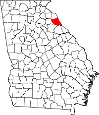 Location within the U.S. state of Georgia | |
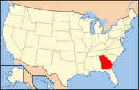 Georgia's location within the U.S. | |
| Founded | 1790 |
| Named for | Samuel Elbert |
| Seat | Elberton |
| Largest city | Elberton |
| Area | |
| • Total | 374 sq mi (969 km2) |
| • Land | 351 sq mi (909 km2) |
| • Water | 23 sq mi (60 km2), 6.2% |
| Population | |
| • (2010) | 20,166 |
| • Density | 57/sq mi (22/km2) |
| Congressional district | 9th |
| Time zone | Eastern: UTC−5/−4 |
| Website | www.elbertco.net |
Elbert County is a county located in the U.S. state of Georgia. As of the 2010 census, the population was 20,166.[1] The county seat is Elberton.[2] The county was established on December 10, 1790 and was named for Samuel Elbert.[3][4]
Contents
1 Geography
1.1 Major highways
1.2 Adjacent counties
2 Demographics
2.1 2000 census
2.2 2010 census
3 Judiciary and government
3.1 Politics
4 Civic
5 Historical and cultural sites
6 Communities
6.1 Cities
6.2 Census-designated place
6.3 Unincorporated communities
6.4 Ghost town
7 Notable people
8 See also
9 References
10 External links
Geography
According to the U.S. Census Bureau, the county has a total area of 374 square miles (970 km2), of which 351 square miles (910 km2) is land and 23 square miles (60 km2) (6.2%) is water.[5]
The northern half of Elbert County, north of a line made by following State Route 17 from Bowman southeast to Elberton, and then following State Route 72 east to just before the South Carolina border, and then heading south along the shores of Lake Richard B. Russell & Clarkes Hill to the county's southeastern tip, is located in the Upper Savannah River sub-basin of the larger Savannah River basin. The portion of the county south of this line is located in the Broad River sub-basin of the Savannah River basin.[6]
Major highways
 State Route 17
 State Route 72
 State Route 77
 State Route 77 Connector
 State Route 79
 State Route 172
 State Route 368
Adjacent counties
Anderson County, South Carolina (northeast)
Abbeville County, South Carolina (east)
McCormick County, South Carolina (southeast)
Lincoln County (southeast)
Wilkes County (south)
Oglethorpe County (southwest)
Madison County (west)
Hart County (north)
Franklin County (northwest)
Demographics
| Historical population | |||
|---|---|---|---|
| Census | Pop. | %± | |
| 1800 | 10,094 | — | |
| 1810 | 12,156 | 20.4% | |
| 1820 | 11,788 | −3.0% | |
| 1830 | 12,354 | 4.8% | |
| 1840 | 11,125 | −9.9% | |
| 1850 | 12,959 | 16.5% | |
| 1860 | 10,433 | −19.5% | |
| 1870 | 9,249 | −11.3% | |
| 1880 | 12,957 | 40.1% | |
| 1890 | 15,376 | 18.7% | |
| 1900 | 19,729 | 28.3% | |
| 1910 | 24,125 | 22.3% | |
| 1920 | 23,905 | −0.9% | |
| 1930 | 18,485 | −22.7% | |
| 1940 | 19,618 | 6.1% | |
| 1950 | 18,585 | −5.3% | |
| 1960 | 17,835 | −4.0% | |
| 1970 | 17,262 | −3.2% | |
| 1980 | 18,758 | 8.7% | |
| 1990 | 18,949 | 1.0% | |
| 2000 | 20,511 | 8.2% | |
| 2010 | 20,166 | −1.7% | |
| Est. 2016 | 19,143 | [7] | −5.1% |
| U.S. Decennial Census[8] 1790-1960[9] 1900-1990[10] 1990-2000[11] 2010-2013[1] | |||
2000 census
As of the census[12] of 2000, there were 20,511 people, 8,004 households, and 5,770 families residing in the county. The population density was 56 people per square mile (21/km²). There were 9,136 housing units at an average density of 25 per square mile (10/km²). The racial makeup of the county was 66.94% White, 30.85% Black or African American, 0.20% Native American, 0.24% Asian, 0.03% Pacific Islander, 1.06% from other races, and 0.68% from two or more races. 2.38% of the population were Hispanic or Latino of any race.
There were 8,004 households out of which 32.00% had children under the age of 18 living with them, 51.90% were married couples living together, 15.70% had a female householder with no husband present, and 27.90% were non-families. 25.00% of all households were made up of individuals and 11.60% had someone living alone who was 65 years of age or older. The average household size was 2.53 and the average family size was 3.01.
In the county, the population was spread out with 25.80% under the age of 18, 8.40% from 18 to 24, 27.20% from 25 to 44, 23.60% from 45 to 64, and 14.90% who were 65 years of age or older. The median age was 37 years. For every 100 females there were 92.20 males. For every 100 females age 18 and over, there were 88.50 males.
The median income for a household in the county was $28,724, and the median income for a family was $34,276. Males had a median income of $27,221 versus $19,737 for females. The per capita income for the county was $14,535. About 14.60% of families and 17.30% of the population were below the poverty line, including 23.50% of those under age 18 and 17.20% of those age 65 or over.
2010 census
As of the 2010 United States Census, there were 20,166 people, 8,063 households, and 5,604 families residing in the county.[13] The population density was 57.4 inhabitants per square mile (22.2/km2). There were 9,583 housing units at an average density of 27.3 per square mile (10.5/km2).[14] The racial makeup of the county was 65.9% white, 29.5% black or African American, 0.6% Asian, 0.2% American Indian, 2.7% from other races, and 1.0% from two or more races. Those of Hispanic or Latino origin made up 4.8% of the population.[13] In terms of ancestry, 18.1% were American, 6.0% were Irish, 5.7% were English, and 5.5% were German.[15]
Of the 8,063 households, 31.9% had children under the age of 18 living with them, 47.9% were married couples living together, 16.5% had a female householder with no husband present, 30.5% were non-families, and 26.9% of all households were made up of individuals. The average household size was 2.47 and the average family size was 2.98. The median age was 41.1 years.[13]
The median income for a household in the county was $30,543 and the median income for a family was $35,550. Males had a median income of $31,556 versus $25,562 for females. The per capita income for the county was $17,100. About 17.0% of families and 23.0% of the population were below the poverty line, including 39.9% of those under age 18 and 11.8% of those age 65 or over.[16]
Judiciary and government
Elbert County is part of the Northern Judicial Circuit of Georgia, which also includes the counties of Hart, Franklin, Madison, and Oglethorpe. Elbert County's governing authority, the Elbert County Board of Commissioners, has five Commissioners elected in districts, a Chairperson elected County-wide, and an appointed County Administrator.
Politics
| Year | Republican | Democratic | Third parties |
|---|---|---|---|
2016 | 66.3% 5,292 | 31.8% 2,539 | 2.0% 156 |
2012 | 59.6% 4,859 | 39.0% 3,181 | 1.4% 116 |
2008 | 58.4% 4,868 | 40.4% 3,366 | 1.2% 98 |
2004 | 60.3% 4,626 | 38.9% 2,984 | 0.8% 58 |
2000 | 55.7% 3,262 | 43.2% 2,527 | 1.1% 64 |
1996 | 40.9% 2,393 | 49.5% 2,900 | 9.6% 564 |
1992 | 38.5% 2,372 | 49.1% 3,025 | 12.5% 770 |
1988 | 56.8% 2,796 | 43.0% 2,118 | 0.2% 11 |
1984 | 55.8% 3,366 | 44.2% 2,670 | |
1980 | 32.5% 1,967 | 66.2% 4,014 | 1.3% 80 |
1976 | 16.9% 961 | 83.1% 4,730 | |
1972 | 76.5% 2,875 | 23.5% 884 | |
1968 | 17.0% 914 | 22.6% 1216 | 60.4% 3,252 |
1964 | 37.3% 1,887 | 62.7% 3,172 | |
1960 | 14.2% 609 | 85.8% 3,672 | |
1956 | 11.0% 447 | 89.1% 3,635 | |
1952 | 14.4% 552 | 85.6% 3,279 | |
1948 | 16.5% 350 | 76.2% 1,617 | 7.4% 156 |
1944 | 19.1% 370 | 80.8% 1,564 | 0.1% 2 |
1940 | 14.7% 357 | 84.5% 2,052 | 0.8% 20 |
1936 | 19.6% 438 | 79.4% 1,772 | 1.0% 22 |
1932 | 3.6% 77 | 95.5% 2,023 | 0.9% 19 |
1928 | 47.0% 931 | 53.1% 1,052 | |
1924 | 5.6% 72 | 79.6% 1,024 | 14.8% 191 |
1920 | 13.0% 187 | 87.0% 1,247 | |
1916 | 9.4% 183 | 90.6% 1,756 | |
1912 | 21.0% 238 | 77.9% 882 | 1.2% 13 |
Civic
Elbert County has many active civic organizations including, but not limited to, the Elbert County Chamber of Commerce, Elbert County Historical Society, Kiwanis Club, Rotary Club, Lions Club, Pilot Club, Elbert Theatre Foundation (part of the Georgia Council for the Arts), NAACP, Boys and Girls Club, Elbert Civic League (part of the Georgia Federation of Women's Clubs), and Habitat for Humanity. Additionally, many local churches have very active missions programs, and many trade organizations, such as the Elbert Granite Association, are active.
Historical and cultural sites
Historical and cultural sites in Elbert County include the Nancy Hart cabin, the Dan Tucker gravesite, the Stephen Heard Cemetery, the Petersburg Township site, Vans Creek Church, the Elbert County Courthouse, the Elberton Seaboard-Airline Depot, the Rock Gym, the Granite Bowl, the Elberton Granite Museum and Exhibit, the Richard B. Russell Dam, the Elbert Theatre, the Georgia Guidestones, Richard B. Russell State Park, and Bobby Brown State Park.
Communities
Cities
- Bowman
- Elberton
Census-designated place
- Dewy Rose
Unincorporated communities
- Fortsonia
- Hard Cash
- Middleton
- Ruckersville
- Rock Branch
Ghost town
- Petersburg
Notable people
Though a rural county, Elbert County has been home to many notable people. Included in these are Revolutionary War heroine Nancy Hart, who resided in southern Elbert County, and the Rev. Daniel Tucker, a popular minister and ferry operator, who may have been the inspiration for the song "Old Dan Tucker". The county was also home to Corra Harris, author of "A Circuit Rider's Wife," a book that later inspired the popular movie "I'd Climb the Highest Mountain." Stephen Heard, deceased, was Governor of Georgia from 1780-1781. Hon. Joseph Rucker Lamar, deceased, who served as a Justice of the Supreme Court of the United States from 1910–1916, was born in Elbert County. Statesman and Judge Young L.G. Harris, deceased, for whom Young Harris College is named, was born in Elbert County. Former U.S. Secretary of War and 1824 U.S. Presidential candidate William Harris Crawford, as well as famed American explorer Meriwether Lewis during his youth; his family owned lands along the Broad River in The Broad River Valley located in Wilkes (now Oglethorpe) County which borders Elbert County. Clark Gaines, NFL record holder and former Executive Director of the NFL Players Association, was raised in Elbert County and played football for Elbert County Comprehensive High School. Blues guitarist Baby Tate was born in Elbert County. Recording artists Modern Skirts, popular on the college music circuit, include two members from Elbert County, JoJo Glidewell and Jay Gulley. Leroy Brewer, grandfather of Governor Earl Leroy Brewer of Mississippi was born in Elbert County in 1793.
See also
- National Register of Historic Places listings in Elbert County, Georgia
- Georgia Guidestones
References
^ ab "State & County QuickFacts". United States Census Bureau. Archived from the original on July 9, 2011. Retrieved June 22, 2014..mw-parser-output cite.citationfont-style:inherit.mw-parser-output .citation qquotes:"""""""'""'".mw-parser-output .citation .cs1-lock-free abackground:url("//upload.wikimedia.org/wikipedia/commons/thumb/6/65/Lock-green.svg/9px-Lock-green.svg.png")no-repeat;background-position:right .1em center.mw-parser-output .citation .cs1-lock-limited a,.mw-parser-output .citation .cs1-lock-registration abackground:url("//upload.wikimedia.org/wikipedia/commons/thumb/d/d6/Lock-gray-alt-2.svg/9px-Lock-gray-alt-2.svg.png")no-repeat;background-position:right .1em center.mw-parser-output .citation .cs1-lock-subscription abackground:url("//upload.wikimedia.org/wikipedia/commons/thumb/a/aa/Lock-red-alt-2.svg/9px-Lock-red-alt-2.svg.png")no-repeat;background-position:right .1em center.mw-parser-output .cs1-subscription,.mw-parser-output .cs1-registrationcolor:#555.mw-parser-output .cs1-subscription span,.mw-parser-output .cs1-registration spanborder-bottom:1px dotted;cursor:help.mw-parser-output .cs1-ws-icon abackground:url("//upload.wikimedia.org/wikipedia/commons/thumb/4/4c/Wikisource-logo.svg/12px-Wikisource-logo.svg.png")no-repeat;background-position:right .1em center.mw-parser-output code.cs1-codecolor:inherit;background:inherit;border:inherit;padding:inherit.mw-parser-output .cs1-hidden-errordisplay:none;font-size:100%.mw-parser-output .cs1-visible-errorfont-size:100%.mw-parser-output .cs1-maintdisplay:none;color:#33aa33;margin-left:0.3em.mw-parser-output .cs1-subscription,.mw-parser-output .cs1-registration,.mw-parser-output .cs1-formatfont-size:95%.mw-parser-output .cs1-kern-left,.mw-parser-output .cs1-kern-wl-leftpadding-left:0.2em.mw-parser-output .cs1-kern-right,.mw-parser-output .cs1-kern-wl-rightpadding-right:0.2em
^ "Find a County". National Association of Counties. Archived from the original on 2012-07-12. Retrieved 2011-06-07.
^ "Elbert County". georgiainfo.galileo.usg.edu. Retrieved 2018-03-19.
^ Gannett, Henry (1905). The Origin of Certain Place Names in the United States. Govt. Print. Off. p. 116.
^ "US Gazetteer files: 2010, 2000, and 1990". United States Census Bureau. 2011-02-12. Retrieved 2011-04-23.
^ "Georgia Soil and Water Conservation Commission Interactive Mapping Experience". Georgia Soil and Water Conservation Commission. Retrieved 2015-11-18.
^ "Population and Housing Unit Estimates". Retrieved June 9, 2017.
^ "U.S. Decennial Census". United States Census Bureau. Archived from the original on May 12, 2015. Retrieved June 22, 2014.
^ "Historical Census Browser". University of Virginia Library. Retrieved June 22, 2014.
^ "Population of Counties by Decennial Census: 1900 to 1990". United States Census Bureau. Retrieved June 22, 2014.
^ "Census 2000 PHC-T-4. Ranking Tables for Counties: 1990 and 2000" (PDF). United States Census Bureau. Retrieved June 22, 2014.
^ "American FactFinder". United States Census Bureau. Archived from the original on 2013-09-11. Retrieved 2011-05-14.
^ abc "DP-1 Profile of General Population and Housing Characteristics: 2010 Demographic Profile Data". United States Census Bureau. Retrieved 2015-12-29.
^ "Population, Housing Units, Area, and Density: 2010 - County". United States Census Bureau. Retrieved 2015-12-29.
^ "DP02 SELECTED SOCIAL CHARACTERISTICS IN THE UNITED STATES – 2006-2010 American Community Survey 5-Year Estimates". United States Census Bureau. Retrieved 2015-12-29.
^ "DP03 SELECTED ECONOMIC CHARACTERISTICS – 2006-2010 American Community Survey 5-Year Estimates". United States Census Bureau. Retrieved 2015-12-29.
^ Leip, David. "Dave Leip's Atlas of U.S. Presidential Elections". uselectionatlas.org. Retrieved 2018-03-19.
External links
- Official website
Places adjacent to Elbert County, Georgia | ||||||||||
|---|---|---|---|---|---|---|---|---|---|---|
| ||||||||||
Municipalities and communities of Elbert County, Georgia, United States | ||
|---|---|---|
County seat: Elberton | ||
| Cities |
|  |
| CDP |
| |
| Unincorporated communities |
| |
| Ghost town |
| |
Atlanta (capital) | ||
| Topics |
|  Seal of Georgia |
| Society |
| |
| Regions |
| |
| Largest cities |
| |
| Counties |
| |
| ||
Coordinates: 34°07′N 82°50′W / 34.11°N 82.84°W / 34.11; -82.84


