West Flanders
West Flanders (Dutch: West-Vlaanderen) | |||
|---|---|---|---|
Province of Belgium | |||
| |||
 | |||
| Coordinates: 51°00′N 03°00′E / 51.000°N 3.000°E / 51.000; 3.000Coordinates: 51°00′N 03°00′E / 51.000°N 3.000°E / 51.000; 3.000 | |||
| Country | |||
| Region | |||
| Capital | Bruges | ||
| Government | |||
| • Governor | Carl Decaluwé | ||
| Area | |||
| • Total | 3,125 km2 (1,207 sq mi) | ||
| Population (1 January 2017)[1] | |||
| • Total | 1,186,532 | ||
| • Density | 380/km2 (980/sq mi) | ||
HDI (2017) | 0.918[2] very high · 5th | ||
| Website | www.west-vlaanderen.be | ||


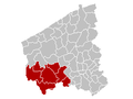
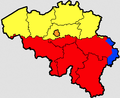
West Flanders (Dutch: West-Vlaanderen [ˌʋɛst ˈflaːndərə(n)] (![]() listen);[3]West Flemish: West Vloandern; French: (Province de) Flandre-Occidentale; German: Westflandern) is the westernmost province of the Flemish Region, in Belgium. It is the only coastal Belgian province, facing the North Sea to the north. It has land borders with the Netherlands to the northeast, the Flemish province of East Flanders to the east, the Walloon province of Hainaut in the southeast and France to the west. Its capital is Bruges (Brugge). Other important cities are Kortrijk in the south and Ostend on the coast, Roeselare and Ypres (Ieper). The province has an area of 3,125 km² which is divided into eight administrative districts (arrondissementen) containing 64 municipalities.
listen);[3]West Flemish: West Vloandern; French: (Province de) Flandre-Occidentale; German: Westflandern) is the westernmost province of the Flemish Region, in Belgium. It is the only coastal Belgian province, facing the North Sea to the north. It has land borders with the Netherlands to the northeast, the Flemish province of East Flanders to the east, the Walloon province of Hainaut in the southeast and France to the west. Its capital is Bruges (Brugge). Other important cities are Kortrijk in the south and Ostend on the coast, Roeselare and Ypres (Ieper). The province has an area of 3,125 km² which is divided into eight administrative districts (arrondissementen) containing 64 municipalities.
The North Sea coast of Belgium, an important tourism destination, lies in West Flanders. A tram line runs the length of the coast, from De Panne on the French border to Knokke-Heist on the Dutch border.
Contents
1 Geography
2 Industry
3 Tourism
4 Language
5 Sport
6 List of Governors
7 Subdivisions
7.1 Arrondissements
7.2 Judicial arrondissements
7.3 Municipalities
8 References
9 External links
Geography
West Flanders consists of the North Sea coast, followed by a very flat polder landscape. Only in the south are some small hills, with the Kemmelberg (159 m) being the highest point in the province. The Leie and IJzer are the main rivers. West Flanders is both the only Belgian province that borders both France and The Netherlands, and the only non-landlocked province.
Industry
In the north of the province, most industry is concentrated in and around the cities of Bruges and Oostende. Both cities also have important seaports: the port of Bruges-Zeebrugge and the port of Ostend.
The south is known for its textile industry, with companies such as Beaulieu and Libeco-Lagae. The region around Kortrijk is called the "Dallas of Belgium" for its entrepreneurship.
Tourism
Tourism is also an important industry in West Flanders. Major touristic attractions include the Belgian coast, the historic center of Bruges, the Yser Tower in Diksmuide and Flanders Fields, the World War I battlefields around Ypres.
Language
The region has a very distinct dialect of Dutch called West Flemish. This distinctive dialect is a part of the strong sense of identity of the inhabitants of the region.
Sport
The city of Bruges has two clubs playing at the highest level of football in Belgium (Belgian First Division A), namely Club Brugge and Cercle Brugge.
Other cities with teams playing at the highest level are Kortrijk (KV Kortrijk), Ostend (KV Oostende) and Waregem (Zulte Waregem).
The teams Knack Randstad Roeselare and Prefaxis Menen play in the highest volleyball league. Knack Randstad Roeselare also plays in the CEV Champions League, the European Championsleague.
BC Oostende is a basketball team which plays in the major basketball league of Belgium.
List of Governors
[citation needed]
- 1830–1831 : Felix de Muelenaere (Catholic Party)
- 1832–1834 : Felix de Muelenaere (Catholic Party)
- 1836–1849 : Felix de Muelenaere (Catholic Party)
- 1849–1857 : Adolphe de Vrière (Liberal)
- 1857–1877 : Benoît Vrambout (Liberal)
- 1877–1878 : Léon Ruzette (Catholic Party)
- 1878–1883 : Theodore Heyvaert (Liberal)
- 1883–1884 : Guillaume De Brouwer (Liberal)
- 1884–1901 : Léon Ruzette (Catholic Party)
- 1901 : Jean-Baptiste de Bethune (Catholic Party)
- 1901–1903 : Charles d'Ursel (Catholic Party)
- 1903–1907 : Jean-Baptiste de Bethune (Catholic Party)
- 1907–1912 : Albéric Ruzette (Catholic Party)
- 1912–1933 : Léon Janssens de Bisthoven
- 1933–1940 : Henri Baels (Catholic Party)
- 1940–1944 : Michel Bulckaert
- 1944–1979 : Pierre van Outryve d'Ydewalle (CVP)
- 1979 : Leo Vanackere (CVP)
- 1979–1997 : Olivier Vanneste (CVP)
- 1997–2012 : Paul Breyne (CVP/CD&V)
- February 2012– : Carl Decaluwé (CD&V)
Subdivisions
Arrondissements
The Province of West Flanders is divided into 8 administrative arrondissements.

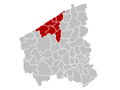
Bruges

Diksmuide
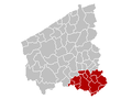
Kortrijk
Ostend
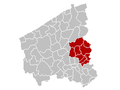
Roeselare
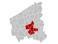
Tielt

Veurne
Ypres


Judicial arrondissements
The Province of West Flanders is divided into 4 judicial arrondissements.

Bruges

Kortrijk

Veurne

Ypres


Municipalities

Municipalities that have city status have (city) after their names.
1. Alveringem
2. Anzegem
3. Ardooie
4. Avelgem
5. Beernem
6. Blankenberge (city)
7. Bredene
8. Bruges (city)
9. Damme (city)
10. De Haan
11. De Panne
12. Deerlijk
13. Dentergem
14. Diksmuide (city)
15. Gistel (city)
16. Harelbeke (city)
17. Heuvelland
18. Hooglede
19. Houthulst
20. Ichtegem
21. Ypres (Ieper) (city)
22. Ingelmunster
23. Izegem (city)
24. Jabbeke
25. Knokke-Heist
26. Koekelare
27. Koksijde
28. Kortemark
29. Kortrijk (city)
30. Kuurne
31. Langemark-Poelkapelle
32. Ledegem
33. Lendelede
34. Lichtervelde
35. Lo-Reninge (city)
36. Menen (city)
37. Mesen (city)
38. Meulebeke
39. Middelkerke
40. Moorslede
41. Nieuwpoort (city)
42. Ostend (city)
43. Oostkamp
44. Oostrozebeke
45. Oudenburg (city)
46. Pittem
47. Poperinge (city)
48. Roeselare (city)
49. Ruiselede
50. Spiere-Helkijn
51. Staden
52. Tielt (city)
53. Torhout (city)
54. Veurne (city)
55. Vleteren
56. Waregem (city)
57. Wervik (city)
58. Wevelgem
59. Wielsbeke
60. Wingene
61. Zedelgem
62. Zonnebeke
63. Zuienkerke
64. Zwevegem
References
^ Population per municipality as of 1 January 2017 (XLS; 397 KB)
^ "Sub-national HDI - Area Database - Global Data Lab". hdi.globaldatalab.org. Retrieved 2018-09-13..mw-parser-output cite.citationfont-style:inherit.mw-parser-output qquotes:"""""""'""'".mw-parser-output code.cs1-codecolor:inherit;background:inherit;border:inherit;padding:inherit.mw-parser-output .cs1-lock-free abackground:url("//upload.wikimedia.org/wikipedia/commons/thumb/6/65/Lock-green.svg/9px-Lock-green.svg.png")no-repeat;background-position:right .1em center.mw-parser-output .cs1-lock-limited a,.mw-parser-output .cs1-lock-registration abackground:url("//upload.wikimedia.org/wikipedia/commons/thumb/d/d6/Lock-gray-alt-2.svg/9px-Lock-gray-alt-2.svg.png")no-repeat;background-position:right .1em center.mw-parser-output .cs1-lock-subscription abackground:url("//upload.wikimedia.org/wikipedia/commons/thumb/a/aa/Lock-red-alt-2.svg/9px-Lock-red-alt-2.svg.png")no-repeat;background-position:right .1em center.mw-parser-output .cs1-subscription,.mw-parser-output .cs1-registrationcolor:#555.mw-parser-output .cs1-subscription span,.mw-parser-output .cs1-registration spanborder-bottom:1px dotted;cursor:help.mw-parser-output .cs1-hidden-errordisplay:none;font-size:100%.mw-parser-output .cs1-visible-errorfont-size:100%.mw-parser-output .cs1-subscription,.mw-parser-output .cs1-registration,.mw-parser-output .cs1-formatfont-size:95%.mw-parser-output .cs1-kern-left,.mw-parser-output .cs1-kern-wl-leftpadding-left:0.2em.mw-parser-output .cs1-kern-right,.mw-parser-output .cs1-kern-wl-rightpadding-right:0.2em
^ Vlaanderen in isolation: [ˈvlaːndərə(n)].
External links
| Wikimedia Commons has media related to West Flanders. |
| Wikivoyage has a travel guide for West Flanders. |
- Official website of the Province of West Flanders
| Communities |
|  | |||||
|---|---|---|---|---|---|---|---|
Regions and Provinces |
| ||||||
| Arrondissements |
| ||||||
Municipalities by region |
| ||||||


