Ghoraghat Upazila
Ghoraghat ঘোড়াঘাট | |
|---|---|
Upazila | |
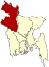
 Ghoraghat Location in Bangladesh | |
| Coordinates: 25°14.7′N 89°13′E / 25.2450°N 89.217°E / 25.2450; 89.217Coordinates: 25°14.7′N 89°13′E / 25.2450°N 89.217°E / 25.2450; 89.217 | |
| Country | |
| Division | Rangpur Division |
| District | Dinajpur District |
| Area | |
| • Total | 148.67 km2 (57.40 sq mi) |
| Population (1991) | |
| • Total | 84,279 |
| • Density | 570/km2 (1,500/sq mi) |
| Time zone | UTC+6 (BST) |
| Website | Official Map of Ghoraghat |
Ghoraghat (Bengali: ঘোড়াঘাট) is an Upazila of Dinajpur District in the Division of Rangpur, Bangladesh.[1]
Contents
1 Geography
2 Demographics
3 Administration
4 See also
5 References
Geography
Ghoraghat is located at 25°14′45″N 89°13′00″E / 25.2458°N 89.2167°E / 25.2458; 89.2167 . It has 17535 house holds and a total area of 148.67 km².
Demographics
As of the 1991 Bangladesh census, Ghoraghat had a population of 84279. Males constituted 51.01% of the population, and females 48.99%. This Upazila's eighteen up population is 43913. Ghoraghat has an average literacy rate of 26.1% (7+ years), and the national average of 32.4% literate.[2]
Administration
Ghoraghat has 4 unions/wards, 115 mauzas/mahallas, and 111 villages.
Member of parliament:Sibli Sadik.
See also
- Upazilas of Bangladesh
- Districts of Bangladesh
- Divisions of Bangladesh
References
^ Shamsuzzaman (2012), "Ghoraghat Upazila", in Sirajul Islam and Ahmed A. Jamal, Banglapedia: National Encyclopedia of Bangladesh (Second ed.), Asiatic Society of Bangladesh.mw-parser-output cite.citationfont-style:inherit.mw-parser-output .citation qquotes:"""""""'""'".mw-parser-output .citation .cs1-lock-free abackground:url("//upload.wikimedia.org/wikipedia/commons/thumb/6/65/Lock-green.svg/9px-Lock-green.svg.png")no-repeat;background-position:right .1em center.mw-parser-output .citation .cs1-lock-limited a,.mw-parser-output .citation .cs1-lock-registration abackground:url("//upload.wikimedia.org/wikipedia/commons/thumb/d/d6/Lock-gray-alt-2.svg/9px-Lock-gray-alt-2.svg.png")no-repeat;background-position:right .1em center.mw-parser-output .citation .cs1-lock-subscription abackground:url("//upload.wikimedia.org/wikipedia/commons/thumb/a/aa/Lock-red-alt-2.svg/9px-Lock-red-alt-2.svg.png")no-repeat;background-position:right .1em center.mw-parser-output .cs1-subscription,.mw-parser-output .cs1-registrationcolor:#555.mw-parser-output .cs1-subscription span,.mw-parser-output .cs1-registration spanborder-bottom:1px dotted;cursor:help.mw-parser-output .cs1-ws-icon abackground:url("//upload.wikimedia.org/wikipedia/commons/thumb/4/4c/Wikisource-logo.svg/12px-Wikisource-logo.svg.png")no-repeat;background-position:right .1em center.mw-parser-output code.cs1-codecolor:inherit;background:inherit;border:inherit;padding:inherit.mw-parser-output .cs1-hidden-errordisplay:none;font-size:100%.mw-parser-output .cs1-visible-errorfont-size:100%.mw-parser-output .cs1-maintdisplay:none;color:#33aa33;margin-left:0.3em.mw-parser-output .cs1-subscription,.mw-parser-output .cs1-registration,.mw-parser-output .cs1-formatfont-size:95%.mw-parser-output .cs1-kern-left,.mw-parser-output .cs1-kern-wl-leftpadding-left:0.2em.mw-parser-output .cs1-kern-right,.mw-parser-output .cs1-kern-wl-rightpadding-right:0.2em
^ "Population Census Wing, BBS". Archived from the original on 2005-03-27. Retrieved November 10, 2006.
Dinajpur District | ||
|---|---|---|
| Upazila/Thana: |
| |
Capital: Rangpur | ||
| Dinajpur District |
|  |
| Gaibandha District |
| |
| Kurigram District |
| |
| Lalmonirhat District |
| |
| Nilphamari District |
| |
| Panchagarh District |
| |
| Rangpur District |
| |
| Thakurgaon District |
| |
This Rangpur Division location article is a stub. You can help Wikipedia by expanding it. |


